Subject: Washington, D.C.
Period: 1815 (dated)
Publication:
Color: Black & White
Size:
11 x 10.5 inches
27.9 x 26.7 cm
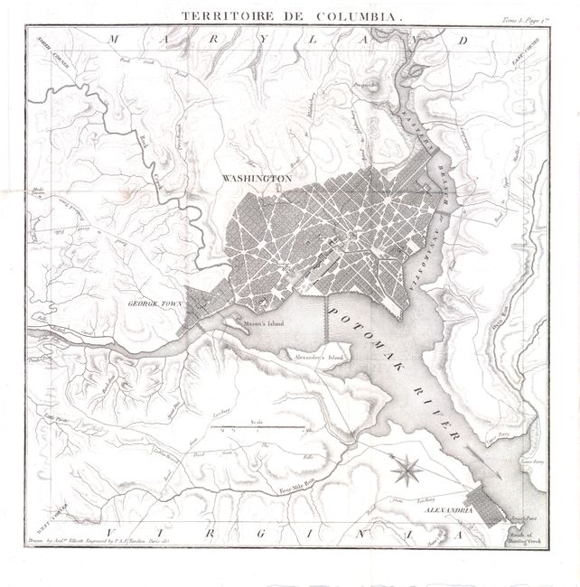
This is a scarce French map based on Andrew Ellicott’s 1793 plan of the Territory of Columbia. It depicts the original 100 square miles of federal territory that became the District of Columbia in 1801, thus including that portion that was ceded back to Virginia in 1846. It covers from Prospect Hill in the north down to Alexandria and Jones' Point in the south. There is good detail of Ellicott’s revised plan of Washington and George Town, with the Capitol and President's House noted. The topography and roads in the surrounding countryside are carefully laid out including the Long Bridge (14th Street Bridge) across the Potomac to Alexander’s Island (Columbia Island) that was built in 1809. Interestingly, this map is oriented with the in the upper left corner of the map, resulting in the map having a square orientation, rather than the diamond shape that was envisioned by Thomas Jefferson and the orientation of Ellicott’s original map.
References:
Condition: B+
Nice clean image with a binding trim in the upper left margin, leaving ample margin for framing. Issued folded.