Subject: Connecticut
Period: 1850 (circa)
Publication:
Color: Hand Color
Size:
22 x 19 inches
55.9 x 48.3 cm
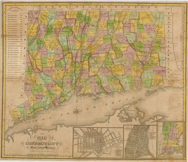
This map of Connecticut shows county boundaries in different color along with towns, canals, roads and railroads. There are three inset maps including "Plan of the City of New Haven", "Plan of the City of Hartford" and "New England States." Yale College is located in the New Haven inset. At left is a table showing the various governors of the state since it's charter. This example is virtually identical to the one in Harvard's collection except this issue has added "1850 Thomas H. Seymour" to the list of governors. Folds into brown cloth boards and gilt lettering.
References: Thompson #112 & #157.
Condition: B
The map is generally in very good condition with a few stains and light toning. The verso has been backed with Japanese tissue to reinforce and repair some minor loss along the folds. The map is issued folded and is separated from the covers.