Subject: Western United States
Period: 1849 (dated)
Publication: Irving's Adventures of Captain Bonneville
Color: Black & White
Size:
5.5 x 8 inches
14 x 20.3 cm
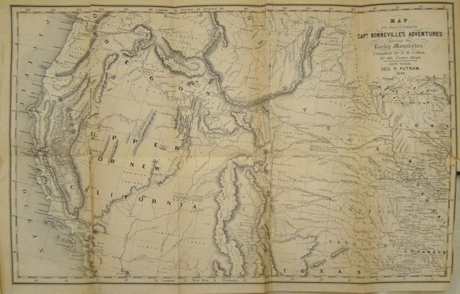
This interesting map is based on Fremont's map. The region west of the Mississippi to the Pacific Ocean is delineated with the rivers and towns of the gold region in California well shown. The expedition route described is that of Captain Benjamin Bonneville who explored the American West from 1832-1836. The expedition party traveled parallel to the course of the Snake and the Columbia Rivers, going as far as Fort Walla Walla before turning back. Fremont's route through California is shown, as well as Kearny's route along the Gila River and the Emigrant route.
The map is still bound in the original "The Adventures of Captain Bonneville, U.S.A., in the Rocky Mountains and the Far West" (5.3 x 7.5"). Published complete in one volume, this is the 1849 "Author's Revised Edition" of Irving's popular works that provides a historical account of Bonneville's three year exploration of the Rocky Mountains. Bonneville did not submit any reports to his superiors in Washington during his hiatus, thus causing the U.S. Army to declare him "virtually deceased," and subsequently removed from the military roster. Hardbound, 428 pp, gilt title on spine and heavy embossed design on covers. A historical and desirable map complete in the original volume.
References: Wagner-Camp #67:14, cf. Wheat (TMW) #424.
Condition: C+
Map is good except for a 2-inch opening tear on the right side with some light toning . The book has light foxing in text and the covers show a little wear but are sound.