Catalog Archive
Auction 137, Lot 220

"Carolina [on sheet with] A Map of ye Island of Bermudos, Divided into its Tribes, w,th the Castles, Forts &c.", Moll, Herman

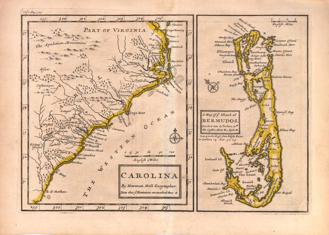
Subject: Colonial Southeast and Bermuda

Period: 1708 (circa)

Publication: The British Empire in America

Color: Hand Color

Size:
10.3 x 7 inches
26.2 x 17.8 cm
Download High Resolution Image
(or just click on image to launch the Zoom viewer)

This is the first edition of the Moll-Oldmixon map, which was derived from the important Gascoyne map of 1682. The primary map covers the coast from Cape Henry to B. St. Matheo, and shows small icons representing the numerous plantations in the vicinity of Charlestown. On the sheet at right is a map of Bermuda engraved within it's own neatline, with castles and forts marked throughout the island. Moll, a Dutchman living in England since 1680, was "the most prolific designer and publisher of maps of Carolina" and was "as open and effective a protagonist for British territorial claims in North America as was Delisle for the French."

References: Cumming #148.

Condition: B+

Toned with some faint creasing near the bottom centerfold.

Estimate: $400 - $500

Sold for: $350

Closed on 9/14/2011

Archived