Catalog Archive
Auction 137, Lot 200

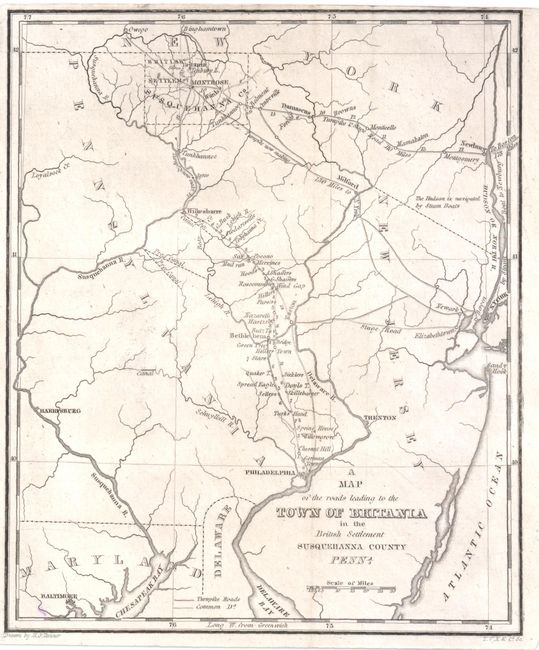
"A Map of the Roads Leading to the Town of Britania in the British Settlement Susquehanna County Penna", Tanner, Henry Schenck

Subject: United States - New England

Period: 1819 (circa)

Publication:

Color: Black & White

Size:
6.5 x 8 inches
16.5 x 20.3 cm
Download High Resolution Image
(or just click on image to launch the Zoom viewer)

This very uncommon early American road map extends from New York in the east, to Baltimore in the south, to the northern border of Pennsylvania. The roads leading from Boston, New York and Philadelphia to Britania are outlined on the map, along with driving distances. The map was published to promote British immigration to Pennsylvania. The settlement of Britania was located just north of Montrose, in Susquehanna county. A notation near the Hudson River states "the Hudson is navigated by steam boats." Current and proposed canals are also depicted.

References:

Condition: B+

Issued folding. A small, unobtrusive spot in bottom-left corner and trimmed close to neatline at top.

Estimate: $100 - $140

Sold for: $75

Closed on 9/14/2011

Archived