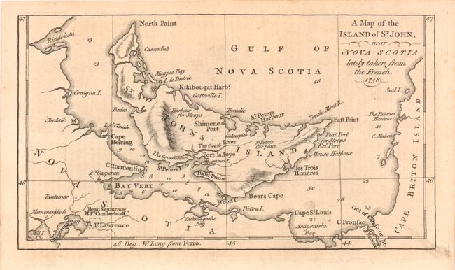
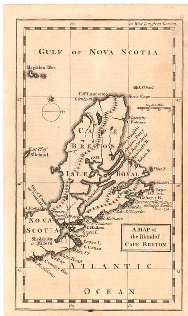
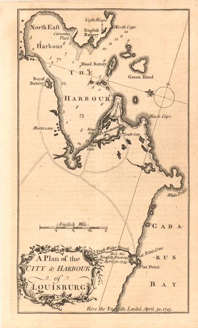
"[Lot of 3] A Map of the Island of St. John, near Nova Scotia lately taken from the French, 1758 [and] A Map of the Island of Cape Breton [and] A Plan of the City & Harbour of Louisburg.", Anon.
Subject: Canada
Period: 1758 (published)
Publication: Grand Magazine of Magazines
Color: Black & White
Three scarce French & Indian Wars maps published in the October, July and August, respectively, 1758 issues of the rare Grand Magazine of Magazines. The magazine's first issue was in July 1758 and it ceased publication with the November 1759 issue. The first map (7.5 x 4.2") provides good detail of the island and extends to show part of Nova Scotia to name Ft. Gasperau, Ft. Cumberland, Ft. Lawrence, the small settlements of Tantemar, Memeramkolk and Shedaik. The second map (4.3 x 7.5) extends to include the Magdalen Isles, I. St. Paul and more. The final map (4.3 x 7.5) has fine detail of the harbor, royal battery, light house and the location of the English Encampment and Landing of April 30, 1745.
References: Jolly GMOM-10, 3 & 5.
Condition: A
Very good condition with a hint of light toning.