Subject: North America
Period: 1780-1800 (circa)
Publication:
Color:
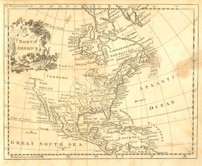
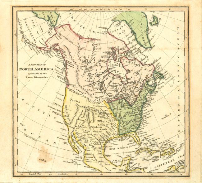
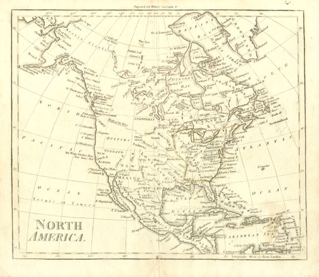
These three small maps provide an interesting view of the developing North American cartography at the end of the 18th and beginning of the 19th centuries.
A. North America from Guthrie's A New Geographical, Historical, and Commercial Grammar, 1780, Black & White (8.8 x 7"). The colonies are confined to the eastern seaboard and most of the continent remains Parts Unknown and the purview of the Native Americans. B condition.
B. A New Map of North America Agreeable to the Latest Discoveries by J. Morse, circa 1800, Hand Colored (9 x 8.5"). The young United States is now shown with it western boundary on the Mississippi River. There are a number of mountain ranges now shown in the west, although most of them are completely spurious. The distinctive River of the West forms a boundary between what is now British Columbia and Washington. Alaska is shown in a rudimentary configuration and the Aleutian Islands are labeled Fox Islands. B condition.
C. North America, from Walker's Geography, circa 1800, Black & White (7.5 x 8.8"). This map is very similar to Morse’s map, but the River of the West is now shown with an indistinct outlet into King Geo. Sound (Puget Sound). B+ condition.
References:
Condition:
See individual descriptions.