Subject: Reference Books
Period: 1976 (published)
Publication: Holmes & Meier Publishers
Color: Black & White
Size:
14.5 x 21 inches
36.8 x 53.3 cm
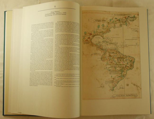
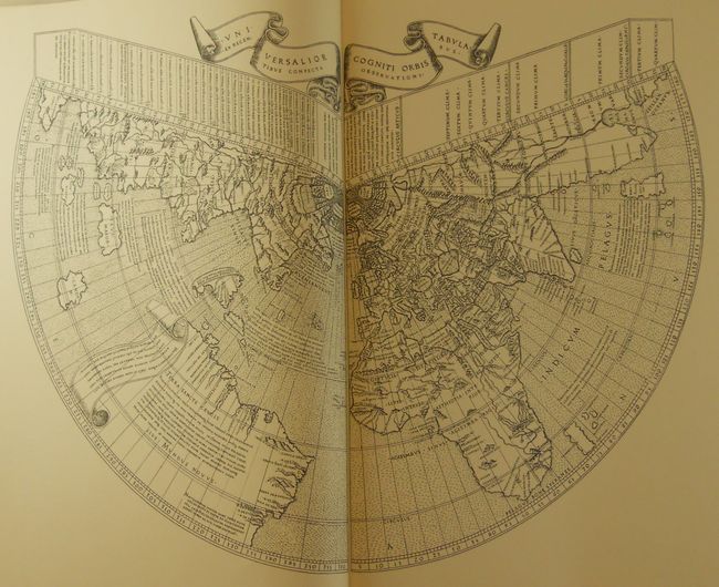
This first edition facsimile volume contains a representative selection of maps produced from the time of Columbus's discovery of America until the middle of the 19th-century, all chosen for their significance, scarcity or both. Includes many rare manuscript maps and printed maps which are not readily accessible elsewhere. Each map is provided with commentary, and includes references as to the origin and content of each map and its relationship to the others. Published in a limited edition of 1200 copies, this is #656. Hard bound in green cloth, in original slipcase. 293pp, 76 maps, some folding, some double page and some in color. Table gives location of all maps. A large and handsome book that was made in Germany in the same manner as an old atlas, with all maps attached to binding strips.
References:
Condition: A+