Subject: North Pacific, Northern Asia and Northwestern North America
Period: 1775-1795 (circa)
Publication:
Color: Black & White
Size:
9.3 x 6.8 inches
23.6 x 17.3 cm
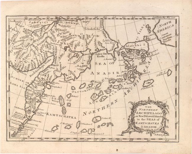
1) A strongly engraved map by Thomas Bowen that shows a highly fragmented Alaska as an archipelago composed of numerous islands, the largest named Alascha I. The map includes the northern Kuril Islands and eastern Siberia and the sea between Asia and North America based on reports of Russian discoveries in the region. Decorative rococo-style title cartouche. Originally published in the May, 1775 of the London Magazine. Very nice example (A).
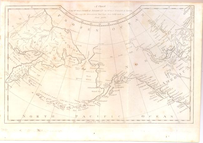
2) The title for the second map continues "Shewing the Discoveries have been lately been name in those parts." This chart correctly shows the Alaska peninsula with the Aleutian Islands named Catherines Archipelago. The map stretches from Kamtschatka to North America with surprising detail in north central Canada. Along the coast numerous place names are located including Cape Flattery, Straits of Juan de Fuca, Queen Charlotte's Island and Montague Island, to mention a few. A British Factory is located by Port Brooks. Mackenzie's tract of 1793 is delineated from the interior to the Pacific Ocean. This map was produced in Boston by Jedidiah Morse, engraved by E.G. Gridley. Two small spots. (B+)
References: 1) Jolly LOND-307.
Condition: