Subject: Paris, France
Period: 1793 (dated)
Publication:
Color: Hand Color
Size:
31 x 21.5 inches
78.7 x 54.6 cm
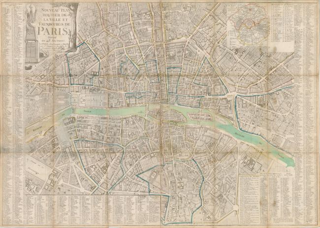
This folding pocket map of Paris was published at the beginning of the Reign of Terror and the same year King Louis XVI was executed. The map shows the city's center in great detail with all streets and boulevards located and named. The important buildings are shown in plan view and each is named. The large index covers both sides and most of the lower edge. It locates at least 1,000 buildings including theatres, hospitals, churches, colleges, etc. The index further lists all major streets and keys them to the map using a grid index. The inset Department de Paris shows the entire city with all Departments, Districts and Cantons. This edition has an expanded index that replaces the insets of Versailles and the Louvre as contained on earlier issues. The radical upheavals of the French Revolution were well underway when this map was published.
References:
Condition: B+
In original color the map is folding with the original blue paper cover attached to one panel, but missing the front cover. The map has a little toning along fold lines and a few tiny fold intersection splits.