Subject: Netherlands
Period: 1696 (circa)
Publication:
Color: Hand Color
Size:
22 x 18.5 inches
55.9 x 47 cm
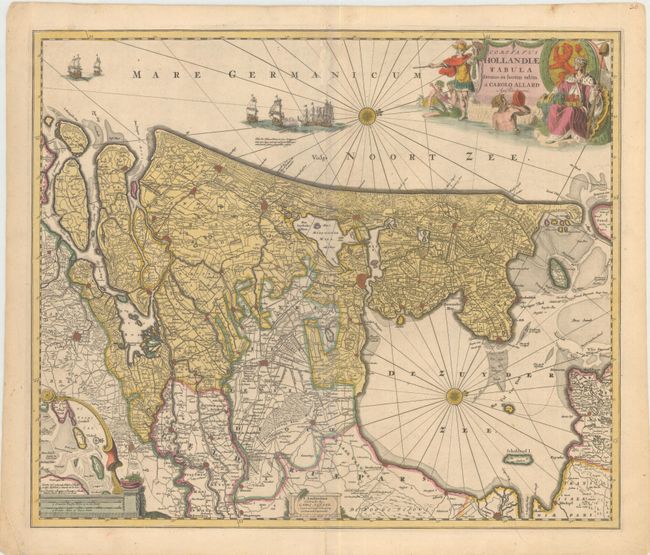
This decorative map depicts Utrecht and parts of Friesland and Brabant with their coasts. The details include canals, roads, polders, marshes, and villages with major cities marked. The West Frisian Islands are shown in an inset. Compass roses orient north to the right and a variety of sailing vessels fill the seas. The title cartouche is surrounded by mermen, the Dutch coat of arms, and a monarch, possibly William III of Orange, the Stadtholder over Utrecht from 1650-1702.
References:
Condition: B
Fine original color with a short separation at centerfold at bottom, with no paper loss. There is a minor abrasion on centerfold at top.