Subject: Wales
Period: 1648-95 (circa)
Publication:
Color: Hand Color
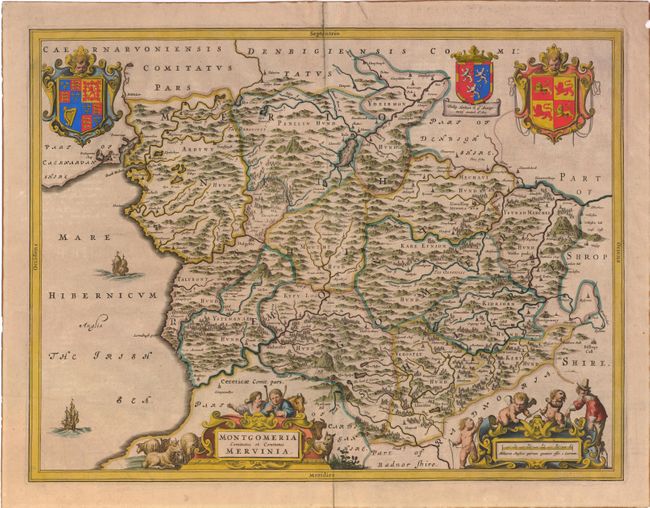
1) Montgomeria Comitatus et Comitatus Mervinia by Johannes Blaeu's Atlas Maior, circa 1648 (19.5 x 15") This is a splendid map of the historic counties of Merionethshire and Montgomeryshire. The two large coats of arms pictured are for Great Britain on the left and Wales on the right. In between is the coat of arms for the Herbert family, in recognition of Philip Herbert, the 1st Earl of Montgomery. The map is richly embellished with two ships sailing in the Irish Sea and two figurative cartouches featuring a surveyor, putti, and Welsh shepherds and their flocks. French text on verso. Sharp impression and nicely colored. Several tears in margin repaired with old paper, one with cello tape. Small hole near Sarnabugh point through the large letter 'R.' (B+)
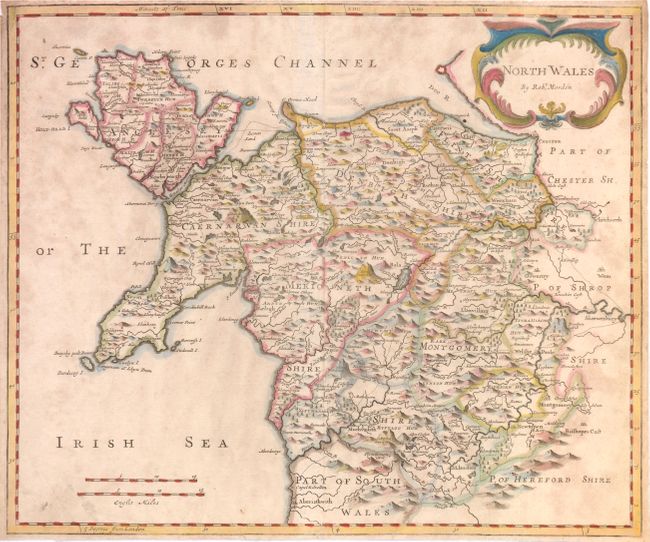
2) North Wales, from Robert Morden's edition of Camden's Brittania, circa 1695 ( 16.8 x 14.2") Beautifully and boldly engraved map that borders the Irish Sea and extends to Aberystwyth in the south and Chester in the north on the Dee River. The map depicts the mountainous topography of the northern part of Wales. Each county is named and outlined. The map includes a bold title cartouche and two distance scales. Trimmed margins with some uneven toning. (B)
References:
Condition: