Catalog Archive
Auction 136, Lot 421

"A Map of the Islands of St. Lucia and Martinique, with Part of Dominica and St. Vincents…", Lodge, John

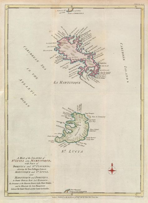
Subject: Martinique and St. Lucia

Period: 1781 (dated)

Publication: Political Magazine

Color: Hand Color

Size:
10.7 x 14.7 inches
27.2 x 37.3 cm
Download High Resolution Image
(or just click on image to launch the Zoom viewer)

An attractive map of Martinique and St. Lucia showing the area of a naval engagement between Sir Samuel Hood and the French Count de Grasse, one of a number of battles between the forces of England against France and Spain for dominion over the islands in the West Indies. This map is simply engraved, with detail primarily on the coasts.

References: Jolly POL-31; Tooley (MCC-81) #33.

Condition: B+

Issued folded, now flattened with a minor binding tear and trim repaired at left.

Estimate: $220 - $275

Sold for: $120

Closed on 6/1/2011

Archived