Subject: Texas
Period: 1902 (dated)
Publication:
Color: Printed Color
Size:
20.5 x 15.5 inches
52.1 x 39.4 cm
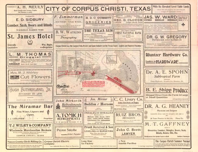
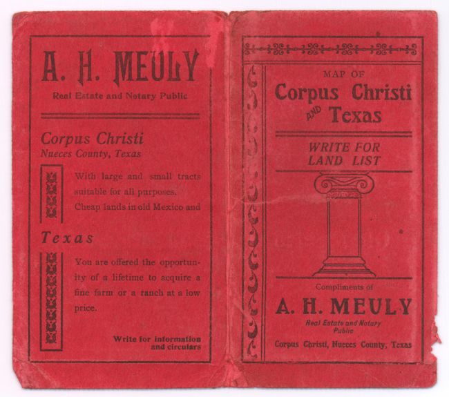
This land promotion map shows railways, towns, county lines, county seats, and the sixteen Congressional Districts in the state of Texas. The north-western portion of the state is shown in an inset, and the area around Corpus Christi is circled in red. On verso is a smaller map, Map of Corpus Christi and Brooklyn, which outlines the various tracts of land available, some of them numbered. Railway depots, the county courthouse, the fair grounds, and other notable features in the town are highlighted, and a small inset map shows Brooklyn. Surrounding the map are dozens of advertisements for physicians, artists, lawyers, grocers, and other businesses, to convince prospective landowners of the growing economy in Corpus Christi. The map is accompanied by original red printed wrappers titled Map of Corpus Christi and Texas … Compliments of A.H. Meuly Real Estate and Notary Public, (3 x 5.5"). The wrappers offer a sales pitch for purchasing land: "You are offered the opportunity of a lifetime to acquire a fine farm or a ranch at a low price."
References:
Condition: A
Short fold separations confined to blank margins and repaired on verso with archival tape. Map has been removed from wrappers and pressed. Wrappers have worn covers with bumped corners and a small chip on fore-edge.