Subject: Canada
Period: 1858-1861 (dated)
Publication: Petermann's Geographische Mittheilungen
Color:
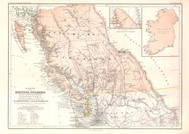
Karte von Britisch-Columbia (Fruher: New-Caledonia), Vancouver I., und dem Nordlichen Theil von Washington Territorium, dated 1858, printed color, (13.5 x 9.7"). This map of British Columbia, formerly known as New Caledonia, features Vancouver Island, Queen Charlotte Island, and the northern part of Washington Territory. An inset map of Ireland is drawn to scale with the larger map and is meant to be used for size comparison. The map includes two distance scales and a key to abbreviations. Condition: Two minute pinholes in border along 125th longitude, otherwise fine. Issued folding.
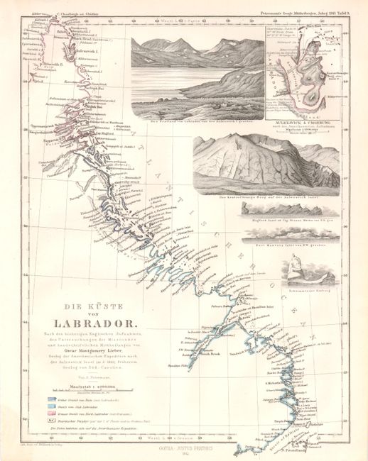
Die Kuste von Labrador, dated 1861, original hand color, (7.4 x 9.8"). This detailed map of the coast of Labrador includes five drawings of the topography in the area as well as an enlarged inset of Aulezavick Island. The inscription after the title indicates that the map is based on the most current English recordings of missionary explorations and the handwritten communications from Oscar Montgomery Lieber, a geologist with the American expedition to Aulezavick Island in 1860, who was previously a geologist from South Carolina.
References:
Condition: A+
See description.