Subject: North America
Period: 1825 (circa)
Publication:
Color: Black & White
Size:
15.5 x 10 inches
39.4 x 25.4 cm
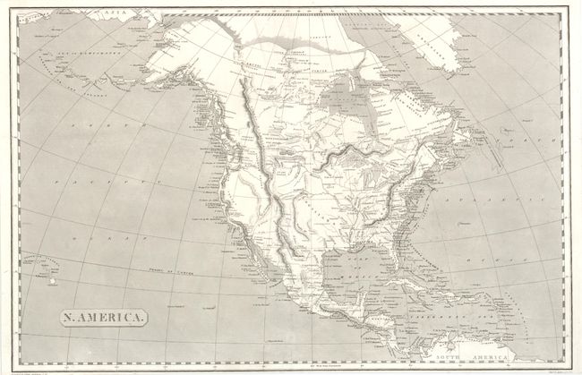
This map incorporates in the Northwest geography from the expedition of Lewis & Clark. It is filled with finely engraved watershed information, Indian lands and topography shown via hachure. California is New Albion and the region of the Great Basin is blank except for a bisecting mountain range. Kansas City is the furthest west settlement. Along the Pacific coast there are many mission towns named including San Diego, San Juan [Capistrano], San Gabriel and Santa Barbara. In the Baja Todos Santos is named. The map extends to show the Sandwich Islands and the Caribbean Islands. Projected by Adam Anderson and engraved by James Kirkwood & Sons of Edinburgh. The seas are fully engraved with ruled lines.
References:
Condition: A
Close trimmed at lower edge just affecting imprints, as issued.