Subject: Pacific Ocean
Period: 1704 (circa)
Publication:
Color: Hand Color
Size:
23.2 x 20.2 inches
58.9 x 51.3 cm
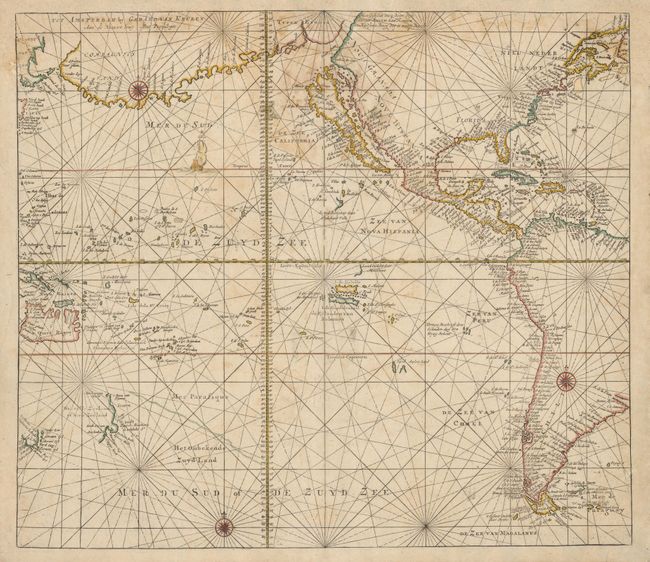
This dramatic sea chart of the Pacific Ocean and the Americas features California as a large island. North America is separated from a large landmass labeled Terra Esonis and Compagnies by the Straet Anian. Early discoveries in the Pacific include parts of western New Zealand and Tasmania. The region of New Guinea is still quite confused but there are numerous islands named, both fictitious and real. The map is decorated with three compass roses, rhumb lines and a sailing ship.
References: Goss (NA) plt. 44; McLaughlin #163; Tooley (Amer) p. 131, #84.
Condition: B
There is some damp stain at top with some paper restoration and facsimile of some of the rhumb lines and publisher's imprint. There are worm tracks at lower sides. The chart has been professionally backed with strong tissue making these flaws unobtrusive.