Subject: Africa
Period: 1725 (circa)
Publication:
Color: Hand Color
The coloring and margins indicate both these maps were published in the same atlas. They make a great comparative study of the mapping of Africa.
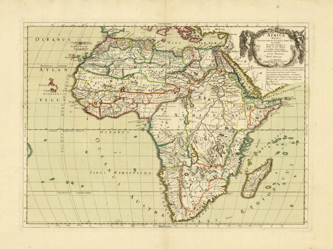
1) Africa Vetus, Guillaume Sanson, 1702, (22 x 16"). The map is divided into regions with classical names and all the tribes of southern Africa are labeled Anthropophagi Aethiopes (cannibals). The interior geography is standard for the period with the origin of the Nile on the Ptolemaic concept. The title is contained in a wreath-style cartouche flanked by putti. First published in 1667, this edition is dated 1702 and includes a note dated 1726 noting the correct location of the source of the Nile. This is a state not noted by Betz.
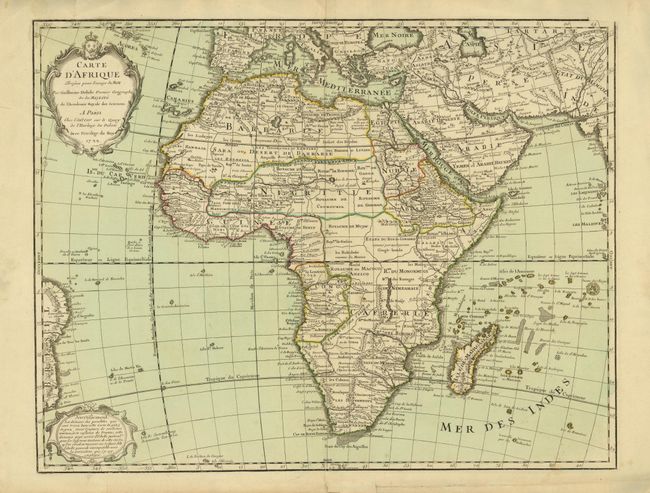
2) Carte d'Afrique dressee pour l'usage du Roy, Guillaume Delisle, 1722, (25 x 19.4"). This important, updated map of the continent and Madagascar details all of Africa, divided into kingdoms and tribes. The source of the Nile is correctly shown in Abyssinia and the Senegal and Niger Rivers are correctly separated for the first time. In the southeastern portion of the continent Lake Moravi is shown well inland from Zanzibar. Two decorative cartouches grace the map. This is not the more common Covens & Mortier issue.
References: 1) Betz #106; Norwich #41; 2) cf Norwich #78, Betz p. 498.
Condition: A
Nice impressions with original color and wide original margins. There are a few edge tears and stains in the margins, all well removed from the first map; the second map has a couple of tears near the neatline at left, closed with archival tape.