Subject: Mauritius, Indian Ocean
Period: 1801 (dated)
Publication: History of Mauritius
Color: Hand Color
Size:
19.3 x 28.3 inches
49 x 71.9 cm
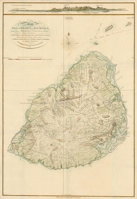
This is a scarce and very precise map of the island of Mauritius which was the French stronghold and naval base in the Indian Ocean. The map was compiled from a number of sources including the distinguished French navigator and hydrographer, D'Apres de Mannevillette and Abbe de la Caille who carried out a remarkably accurate triangulation survey in 1753. The map provides a very detailed view of the island with roads, plantations, towns, and mills located, and excellent navigational information along the coastlines. A coastal approach view of Port Louis is at top.
References:
Condition: B+
Printed on heavy paper, issued folding, now flattened with folds repaired and reinforced with tissue on verso. There is some unobtrusive tissue on blank areas of the face of the map.