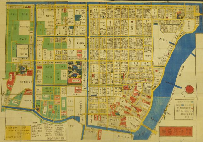
Subject: Tokyo, Japan
Period: 1863 (published)
Publication:
Color: Hand Color
Size:
20 x 28.5 inches
50.8 x 72.4 cm
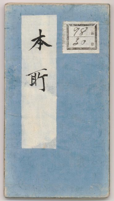
The map shows Honjo, one of the neighborhoods in the ward or borough of Sumida-du, part of Edo (Tokyo). It is a fine wood-block pocket map that self-folds into blue paper ends complete with the original paper labels attached. The map is very detailed, locating many streets and several waterways. The important places are shown within the map as a vignette of the building. The survey for this map was accomplished Ansei 2 (1855), edition was published Bunkyuu 3, or 1863. By cartographer Tomatsu Masakuni, published by Owariya Seishichi Kojimachi 6-chome, Tokyo. These city plans were important to the public and were thought to be updated monthly. Blank verso. A nice example of Japanese craftsmanship and the woodblock art.
This is a map from a kiriezu, which were collections of small-scale maps that covered all of Tokyo in approximately 30 separate maps. Published between the 1840s and 1860s there were two competing sets of these maps. They were constantly updated and presented each district in full color with high detail. Because they were produced primarily as tourist maps they often used vignettes of features, such as temples, samurai residents, and other places of interest, placed at their location. They also located more utilitarian places such as restaurants and other businesses required by the tourist. These maps were subject to frequent updates, evidenced by the surviving blocks that show multiple alterations.
References: Kornicki (The book in Japan: a cultural history…) p. 62.
Condition: A+
This pocket map is in remarkable condition given its age, intended use and fragility of construction. No physical flaws and bright color.