Subject: Tokyo, Japan
Period: 1859 (dated)
Publication:
Color: Hand Color
Size:
26.8 x 24.7 inches
68.1 x 62.7 cm
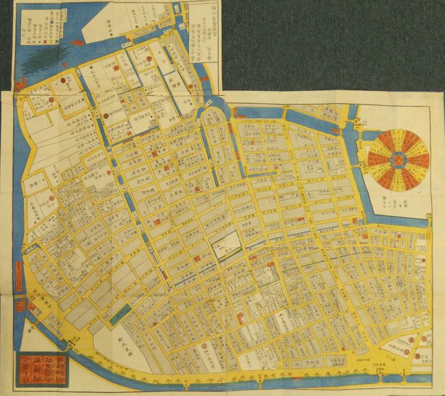
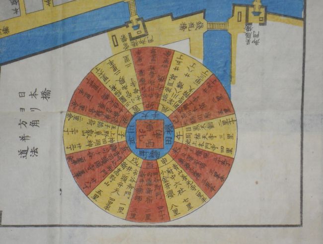
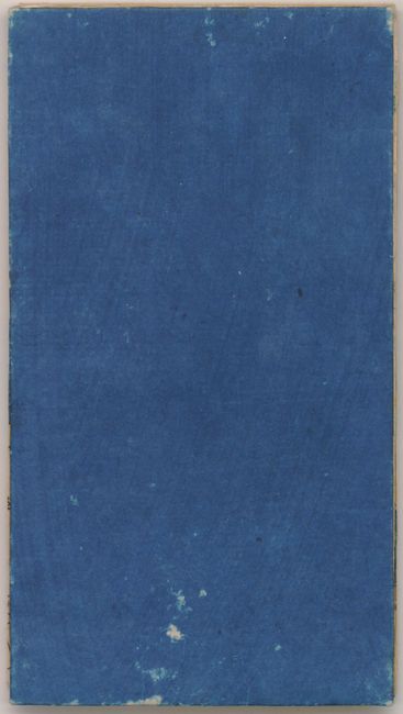
The title given above translates to "Nihonbashi Kita. Kanda Hamamachi Ezu" with the inner title "Nihonbashi Kita Uchi Kanda Ryogoku Hama machi meisai Ezu." The map shows the central part of Tokyo to include the districts of Kanda, Hamamachi, and the northern part of Nihonbashi. In one corner is a colorful calendar that lists the Chinese zodiacal calendar, a twelve-year cycle arranged in a circular pattern. The Nihonbashi bridge was the reference point from which all distances were measured in Tokugawa times. This map shows the bridge and gives the directions and distances of major places from this "zero" point. These maps were important to the public and were thought to be updated monthly. As given on the map, it was originally engraved or surveyed Kaei 3 (1850), this being the updated and newly engraved edition of Ansei 6, or 1859. It is a fine wood-block pocket map that self-folds into blue paper ends. Very detailed, the map locates many streets and several waterways in the downtown, reminiscent of Venice. Blank verso. Reportedly engraved by Fukuzumi Seishichi and published by Owaraya Seishichi. A very nice example of Japanese craftsmanship and the woodblock art.
This is a map from a kiriezu, which were collections of small-scale maps that covered all of Tokyo in approximately 30 separate maps. Published between the 1840s and 1860s there were two competing sets of these maps. They were constantly updated and presented each district in full color with high detail. Because they were produced primarily as tourist maps they often used vignettes of features, such as temples, samurai residents, and other places of interest, placed at their location. They also located more utilitarian places such as restaurants and other businesses required by the tourist. These maps were subject to frequent updates, evidenced by the surviving blocks that show multiple alterations.
References: Kornicki (The book in Japan: a cultural history…) p. 62.
Condition: A+
Remarkable condition given its age, intended use and fragility of construction. The paper covers do not have paper labels as traditionally found. No physical flaws and bright color.