Catalog Archive
Auction 135, Lot 567

"Haaven-Kaart van Eenige Voornaamste Haavens Leggende in de Middel-Landsche Zee en Archipelago", Keulen, Johannes van

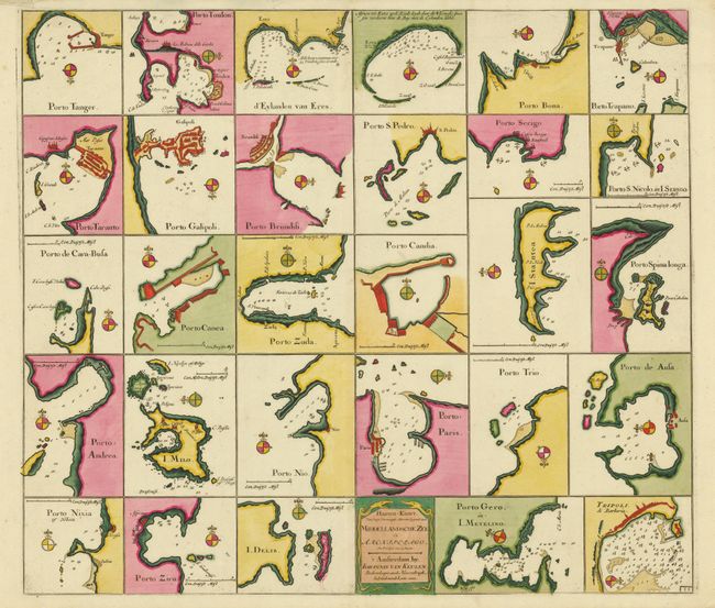
Subject: Mediterranean

Period: 1700 (circa)

Publication: De Nieuwe Groote Lichtende Zee-Fakkel

Color: Hand Color

Size:
23 x 20 inches
58.4 x 50.8 cm
Download High Resolution Image
(or just click on image to launch the Zoom viewer)

The is a superb chart illustrating 29 ports in the Mediterranean. Each chart is oriented by a compass rose and includes soundings, locations of docks, anchorages, and navigational hazards. The fortifications are shown in great detail along with other information such as salt fields and wind mills. This is the first state with 29 plans and a title cartouche.

References:

Condition: A

A fine example with original color with the fleur-de-lis on the compass rose all highlighted in gold leaf. There are a couple tears in the top margin.

Estimate: $600 - $700

Sold for: $800

Closed on 2/16/2011

Archived