Subject: France
Period: 1640-1692
Publication:
Color:
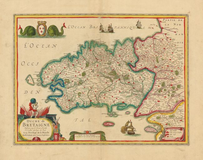
1) Duche de Bretaigne, Jansson, hand color, (19.8 x 14.7"). This richly decorated map of Brittany is fully engraved to suggest forests, rivers, cities and villages. It is embellished with a splendid title, distance scale, and legend cartouches, plus battling sailing ships, and a coat of arms flanked by sea monsters. The title cartouche features Atlas holding aloft the globe. The map was drawn by Le Sieur Claude Hardy for Jodocus Hondius' edition of Mercator's Atlas in 1630; this edition published by Jan Jansson, circa 1650.
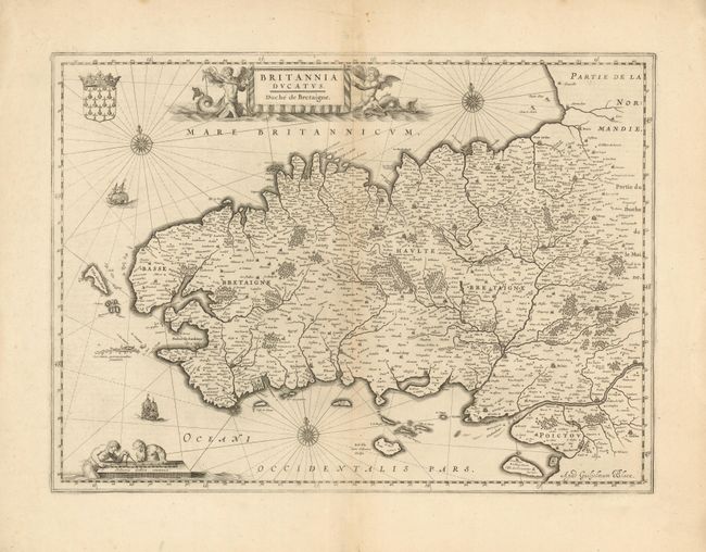
2) Britannia Ducatus - Duche de Bretaigne, Willem Blaeu, circa 1640, black & white, (20.7 x 15"). This richly decorated map of northeastern France is fully engraved with forests, rivers, cities and villages. The splendid title and distance scale cartouches features mermen. Two sailing ships, three compass roses and a coat of arms further decorate this fine map.
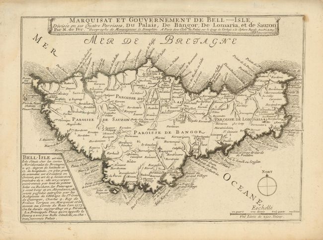
3) Marquisat et Gouvernement de Bell-Isle. Divisee en ses Quatre Paroisses, du Palais, de Bangor, de Lomaria et de Sauzon, Nicolas de Fer, from Les Forces de l' Europe…, circa 1692, black & white, (11.3 x 8.3). Small decorative map of Belle-Isle off the coast of Brittany. The map provides good detail of the topography, ports, cities and towns.
References:
Condition: B+
There is some minor toning or faults in margins, else very good.