Subject: Ireland
Period: 1609 (circa)
Publication:
Color: Hand Color
This lot contains a matched group of 3 of the 4 Irish maps from a French edition of the Mercator Hondius Atlas.
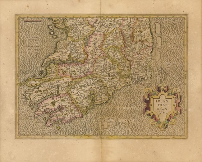
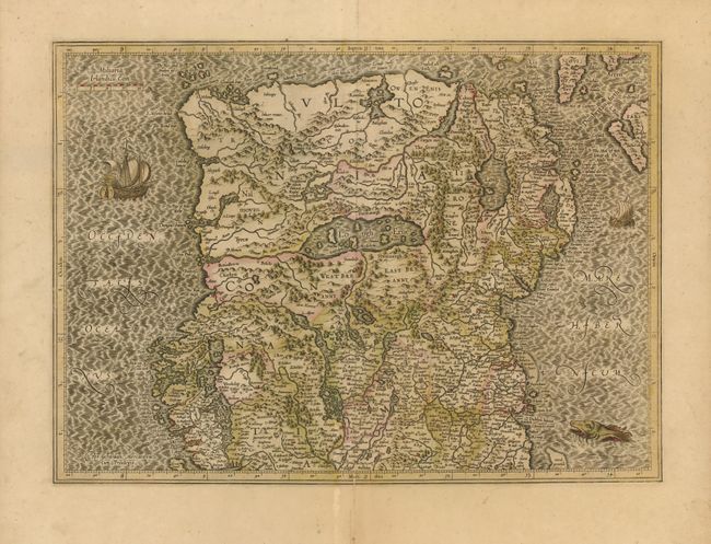
1) Irlandiae Regnum, (18.5 x 13.5"). This is the scarce early edition that covers the whole of Ireland on two sheets. The maps are richly engraved with a moiré pattern in the seas and strong topographical features in the interior. The southern sheet features the bold, strapwork title cartouche. The northern sheet is decorated with sailing ships and a sea monster, and Mercator's imprint. Size given is for each map. Both in original color with full margins. The northern sheet has a short split on centerfold that is just into lower border and a tiny crack at centerfold. (B+) The southern sheet is very good. (A)
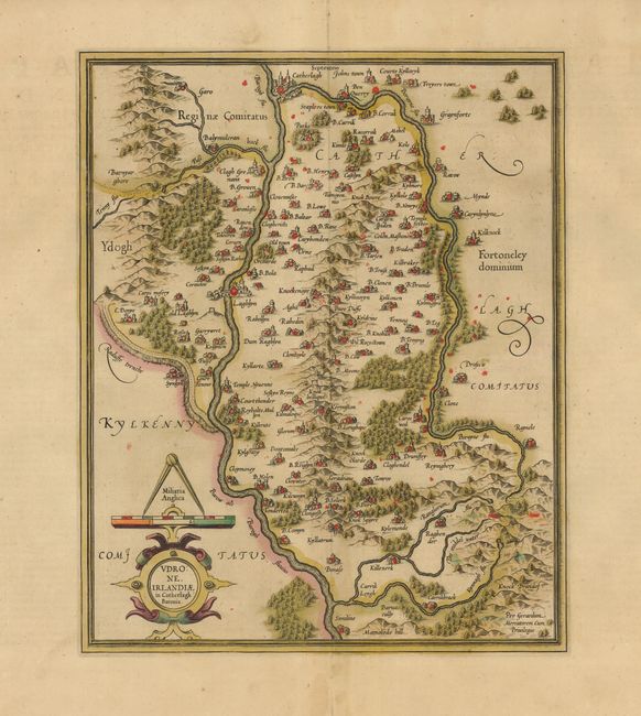
2) Udrone, Irlandiae in Catherlagh Baronia, (11 x 13.5"). A fine map of Udrone - present-day County Carlow in Leinster province. The map is richly engraved to show the mountains, rivers, forests, villages and the two major cities of Catherlagh (Carlow) and Laghlyn (Leighlin Bridge). The strapwork title cartouche incorporates a distance scale. A beautiful, dark impression with original color on a full sheet with enormous margins. Short split at lower centerfold well away from map image. (A)
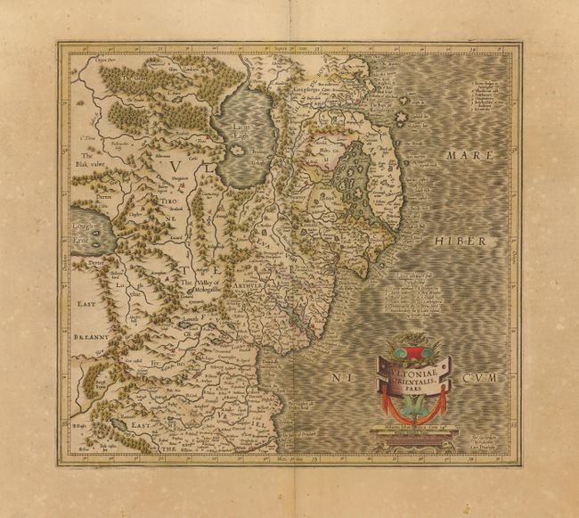
3) Ultoniae Orientalis Pars, (15 x 13.8"). Superb early map covering Down and Antrim Counties in Northern Ireland. It is beautifully engraved with a moiré pattern in the sea, strong topographical features in the interior, and ornamented with a title cartouche incorporating the distance scale. Very nice impression and original color on a full sheet with very wide margins with some toning. (B+)
References: Law pp. 19-20.
Condition:
See individual descriptions.