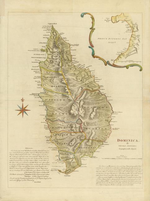
Subject: Dominica
Period: 1768 (published)
Publication: A general topography of North America and the West Indies
Color: Hand Color
Size:
18.7 x 24.4 inches
47.5 x 62 cm
This is a rare and very early, large-scale map of the island of Dominica, one of the few Caribbean islands that remained largely free of colonial incursions until the eighteenth century. Largely due to Dominica's position between Martinique and Guadeloupe, France eventually became predominant, and French settlements were established along the coastlines. In 1761 a British expedition led by Lord Rollo was successful and the island became a British possession in 1763. The map shows the mountainous topography, volcanoes, and savannas. It is divided into ten Quarters and includes a large inset of Prince Rupert's Bay. Sailing directions and an interesting description of the island are included. Published by Robert Sayer and Thomas Jefferys. We can find no dealer or auction records for this map in the past 25 years.
References: Tooley (MCC-62) #2.
Condition: A
Nice impression printed on strong paper with wide original margin with just a hint of light toning. The centerfold has been repaired in the right blank margin.