Subject: Southwest United States & Mexico
Period: 1848 (circa)
Publication: A New General Atlas
Color: Hand Color
Size:
19.7 x 16 inches
50 x 40.6 cm
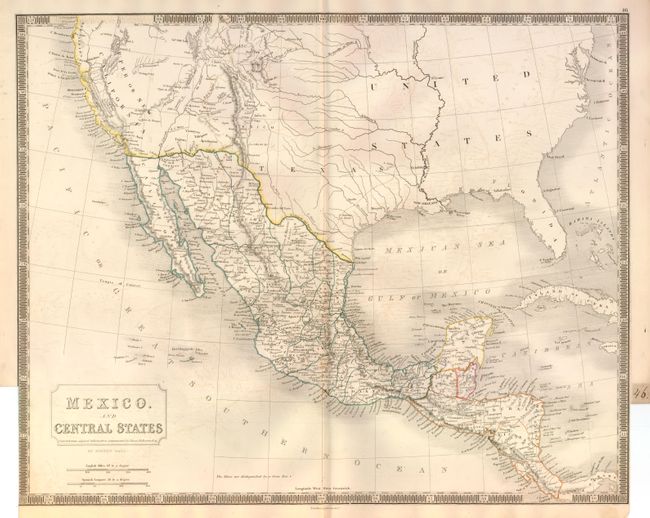
Finely engraved map showing the newly formed state of Texas. Within Texas the settlements of Austin, S. Antonio de Bexar and Houston, but little else. Simon Bourne, a Briton and friend of Stephen Austin, made a copy of Austin's' manuscript map of Texas. Upon returning to England he shared the information with Sidney Hall, who produced this map, first published in 1828. This updated version details the territorial gains by the United States with a pre-Gadsden Purchase border. In California Sutter's settlement of New Helvetica is noted, but no sign of the Gold Strike appears on this map. It presents excellent detail throughout Mexico and Central America. The southwest is labeled Upper or New California and the Baja here is Old California. The small region of New Mexico is located. Boldly engraved keyboard style border. Published by Longman & Co.
References: cf Wheat (TMW) #381.
Condition: B+
Nice impression and original color. A little light offsetting in blank ocean. The map is trimmed nearly to border at lower right and left to create an atlas tab with page number 46 in manuscript black ink, as issued.