Subject: Texas
Period: 1879 (circa)
Publication:
Color: Printed Color
Size:
19 x 19.3 inches
48.3 x 49 cm
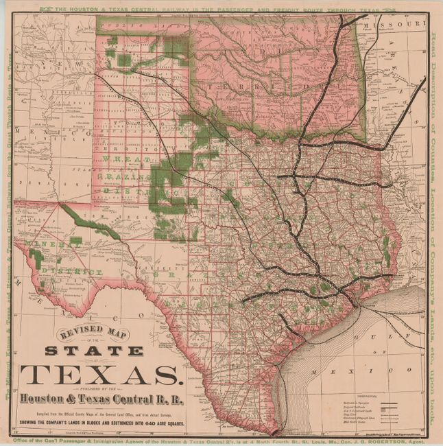
This rare folding map details the extensive holdings of the Houston & Texas Central Railroad which are "Sectionized into 640 Acre Squares" and highlighted in green overprinting. The map shows all railroads in operation, Projected Railroads, stage lines, the mail routes, Government Telegraphy Lines, watershed and more. This Rand McNally produced map shows the main rail routes in very bold black lines with each station identified and named. Green overprinting "Mineral District" in western Texas and the south central region is likewise labeled "Grazing District." All of Indian Territory is included, with the panhandle already separate and labeled Public Lands. The blank margins are filled with green overprinting advertising the railroads and land offerings. The map was "Compiled from the Official County Map of the General Land Office, and from Actual Surveys." Blank verso. Folding as issued and apparently separately issued.
References: Day p. 92 [1876].
Condition: A+
Folding as issued. The uncommon paper carries a faint pink tone.