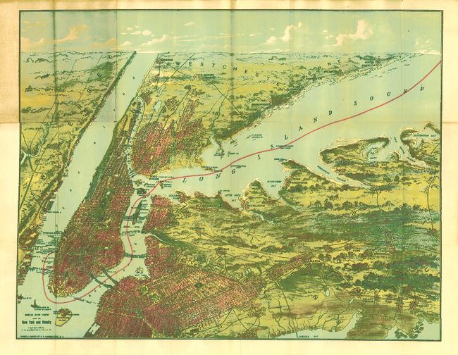
Subject: New York City
Period: 1909 (dated)
Publication:
Color: Printed Color
Size:
21.8 x 16.8 inches
55.4 x 42.7 cm
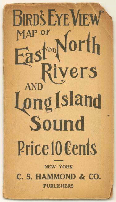
A great chromolithographic birds-eye view that encompasses the entire area from the Jersey Shore to Huntington Bay. The map presents a wide prospective that locates Manhattan, Brooklyn, The Bronx, Mount Vernon, Greenwich, Flushing, Jamaica, Queens, Mineola, Cold Spring, and more. Manhattan shown connected by the Brooklyn, Manhattan, Williamsburg, and Queensboro Bridges, plus numerous smaller bridges on the upper eastside across the Harlem River. This is a colorful pocket map that folds into printed wrappers (3.5 x 7.5") with title, "Bird's Eye View Map of East and North Rivers and Long Island Sound Price 10 Cents." A very nice example of this early tourist map.
References:
Condition: B+
The map is fine less some areas of toning adjacent to covers with splits and tape repairs on verso. Covers toned at edges with some chipping.