Subject: Southwestern United States
Period: 1862-66 (published)
Publication: Illustrated Family Atlas
Color: Hand Color
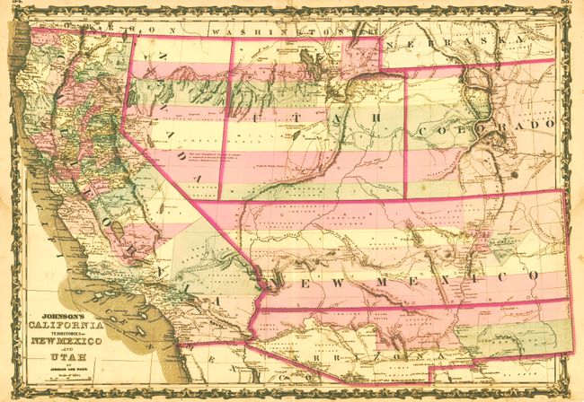
Johnson's California Territories of New Mexico and Utah, by Johnson & Ward, 1862, (24 x 16.8"). This is one of the most desirable editions from this great series of maps covering the Southwest. Arrizona shows up in the southern part of New Mexico Territory. This is thought to represent the Confederate Territory of Arizona that existed for nearly a year from August 1861 until July of 1862. The Confederate General Baylor appointed himself the territorial governor and claimed all of New Mexico Territory south of the 34th parallel. In the southern part of Arizona is the "Gadsden Ten Million Purchase of Mexico." The Utah/Nevada border follows the 116th meridian. The map is filled with historic and interesting notations, and the majority of the early counties are shown as strips running east to west. One note in the area of Quartzite, Arizona refers to the area as being "exceedingly fertile and abundantly timbered and well watered." Additional details include the U.S. Mail routes, the Emigrant road to California, the proposed railroad route through Utah, Nevada and California, and the Pony Express trail. A very desirable issue. Very nice original color and strong impression. Close borders, probably as issued. A few short edge tears in blank margins. The map image is virtually flawless except for a small stain at centerfold near the bottom. (A)
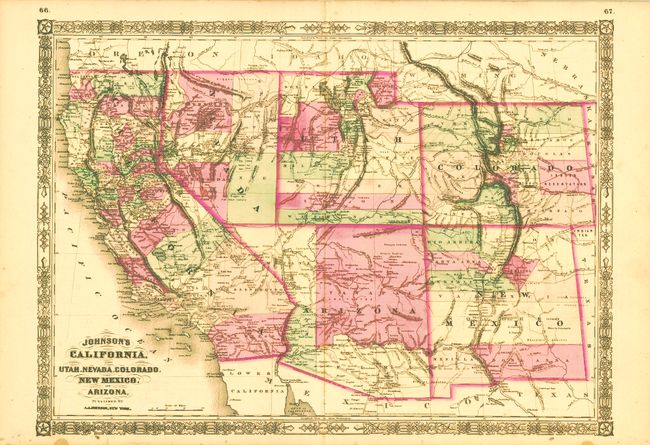
Johnson's California, also Utah, Nevada, Colorado, New Mexico and Arizona, by A. J. Johnson, 1864, (23.5 x 16.8"). This is the early 1864 edition and is one of the first maps to show the original four counties in the newly organized Arizona Territory. The Utah/Nevada border is still at 115° and Arizona contains the southern tip of Nevada including the tiny settlement of Las Vegas. This is a completely new map from earlier plates with many changes in watershed and mountain detail with several of the earlier notations removed. Details the U.S. Mail routes, the Emigrant roads to California, the proposed railroad route through Utah, Nevada and California, and the Pony Express trail. Terrific details throughout. A near fine example save for a few very light spots along centerfold. (B+)
References:
Condition:
See individual descriptions.