Subject: World
Period: 1705 (circa)
Publication:
Color: Hand Color
Size:
17.8 x 13 inches
45.2 x 33 cm
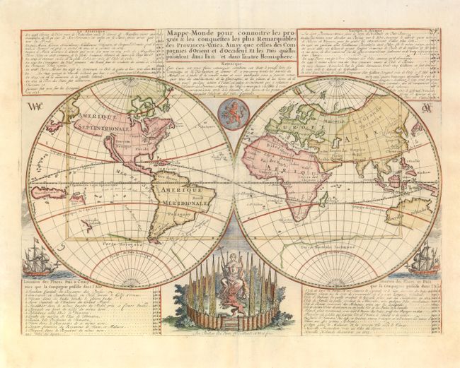
The voyages and discoveries of the Dutch East India Company (VOC) and other Dutch trading companies are the subject of this handsome, double-hemisphere map of the world. California is shown as a prominent island, the Great Wall is shown in China, and the incomplete coasts of Australia and New Zealand are shown in the South Pacific. The tables describe the voyages by Dutch explorers and important events in the Dutch colonies - from 1594 (the first attempt to find a Northeast Passage to Asia) to 1665 when New Holande (New York) was captured by the British. The map is beautifully decorated with ships, a medallion and a female figure seated within an elaborate fortification holding a horn of plenty with a staff topped with a liberty cap, and guarded by a lion representing Holland. First published without the decorative elements around 1670; this is the later edition published by Chatelain.
References: Shirley #447.
Condition: A
Margins have been slightly trimmed but are still very ample.