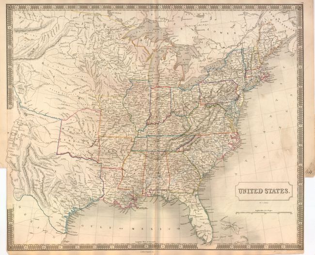
Subject: Eastern United States, Texas
Period: 1847 (published)
Publication:
Color: Hand Color
Size:
20 x 16.6 inches
50.8 x 42.2 cm
This beautifully engraved chart shows the Independent Republic of Texas with the stovepipe extension up to about 42°. The mid-west is a huge Nebraska Territory and the Western Territory is wedged between Arkansas and Texas and extending north to the Kanzas River. Wisconsin is delineated but there is no sign of Minnesota, instead a vast and ill-defined area is simply Dacota. The map extends to include all of Texas to show Santa Fe, Albuquerque and Taos. The Spanish Road is not shown on this edition, but an unnamed road runs from Santa Fe to the Arkansas River and on to Little Rock. The map is densely engraved with hundreds of towns and villages named, fine watershed detail and locates many Indian villages. Surrounded in a bold keyboard style border. Published by Longman & Co.
References:
Condition: B+
Some light offsetting visible in blank ocean and one small smudge at right border. The map is trimmed nearly to border at lower right and left to create an atlas tab with page number 44 in manuscript black ink, as issued. Printer's crease near center.