Subject: Western Hemisphere - Franklinia
Period: 1848 (circa)
Publication:
Color: Hand Color
Size:
17 x 13.5 inches
43.2 x 34.3 cm
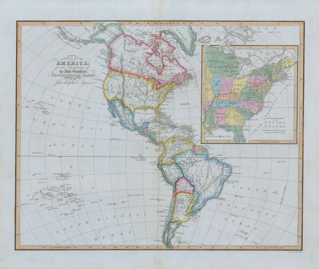
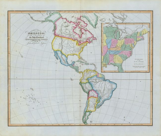
This lot includes matching maps for the "Geographical Games," which contain identical content and coloring, but one is without place names. They are very unusual and interesting maps illustrating the political divisions in America. The large inset shows the eastern United States, which extends to just beyond the Mississippi River. This inset gives a very late depiction of the proposed state of Franklinia. In 1785, settlers in western North Carolina and what would become eastern Tennessee organized a state government to be named in honor of Benjamin Franklin. Congress turned down their appeal but the state maintained a legislature and governor until 1788. This ephemeral state appears on only a small number of maps and this is a late appearance of this frontier political experiment. This scarce map was not included in Baynton-Williams' Map Collector article, "Maps marking the American State of Franklin," (TMC-72, pp12). Uncommon to find these matching game maps together, more so in this condition.
References:
Condition: A+
Very nice examples on blue paper with strong impression and coloring and full margins. One with a short split on centerfold in blank lower margin.