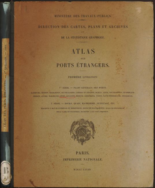
Subject: Atlases, Sea Ports
Period: 1884 (dated)
Publication: Ministere des Travaux Publics
Color: Printed Color
Size:
10.5 x 13.4 inches
26.7 x 34 cm
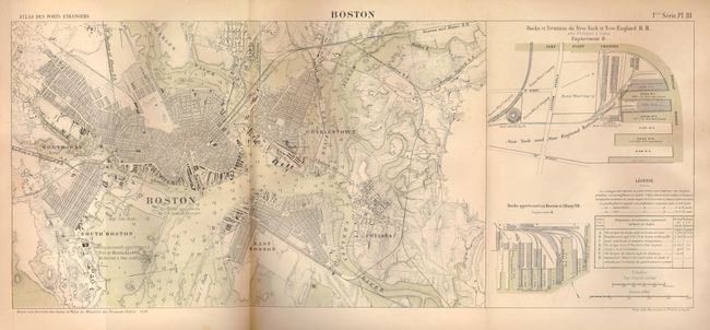
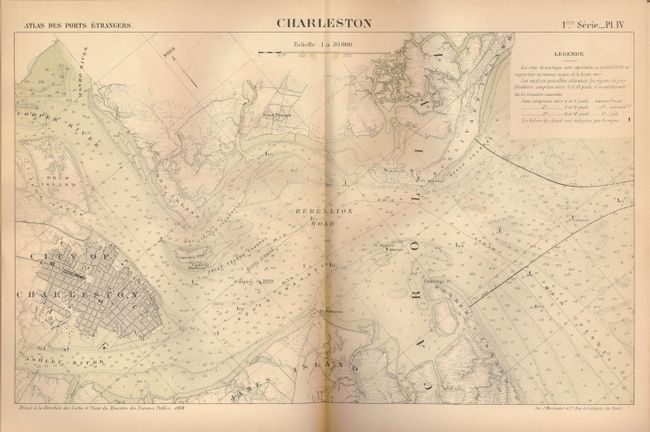
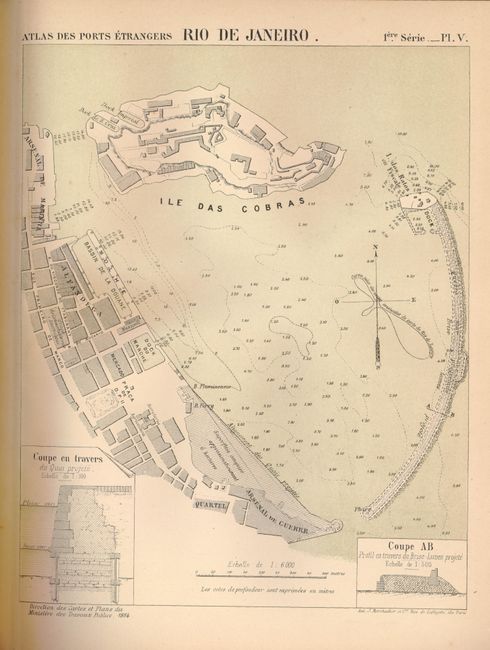
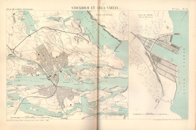
This rarely seen atlas contains charts of 'foreign' ports from France's perspective. Complete with 25 maps, most are large folding or even double folding. Published by the "Ministere des Travaux Publics. Direction des Cartes, Plans et Archives et de la Statistique Graphique." Contains 20 ports: Hamburg, Hamburg (piers and wharfs), Boston, Charleston, Rio de Janeiro, Cardiff and Penart, Dublin, Leith, Southampton, Sunderland, Trieste, Anvers, Barcelona, Genes, Livourne, Messine, Christiania, Barre de Porto (Portugal), St. Petersburg, and Stockholm. And an additional five maps detailing Docks, Quays, cranes, machinery and dry docks, etc. The Dock Clark is a beautifully drawn stone lithograph detailing an extensive shipyard with floating dry docks and repair facilities with numerous sail and steam ships. The Southampton docks is a tinted stone birds-eye view of the shipyard and industrial city. Each folding plate has the original pasted paper label with title and plate number on blank verso of the map. Paper over boards with cloth spine, two title pages, Notice, Table of Charts, twenty-five maps or views. Original paper label on spine.
References:
Condition: B+
A little foxing on front board and a bit of shelf wear to covers. Contents tight and maps vary A to A+ with just a few B+ due to occasional foxing. Old owner's small blue stamp on title page. A sound atlas.