Catalog Archive
Auction 134, Lot 718

"Carte de la Nle. Galles Merid. ou de la Cote Oriental de la Nle. Hollande Decouverte et Visitee par le Lieutenant J. Cook, Commandant de l'Endeavor, Vaisseau de sa Majeste en 1770", Cook/Benard
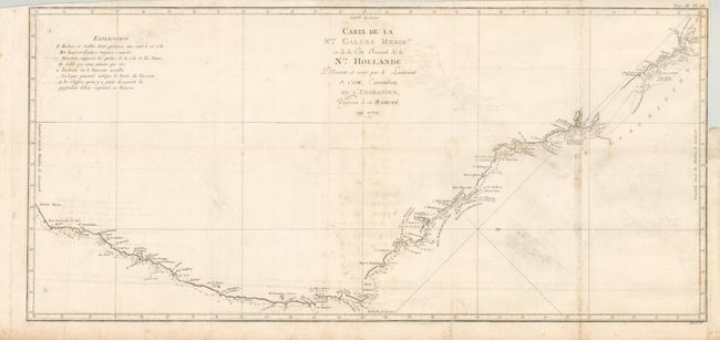
Subject: Australia

Period: 1774 (circa)

Publication:

Color: Black & White

Size:
30.6 x 14.2 inches
77.7 x 36.1 cm
Download High Resolution Image
(or just click on image to launch the Zoom viewer)

This important map documents the first European discovery of the east coast of Australia. It is oriented with north to the right and covers from Cape Howe to Cape York. It shows the routes of the Endeavor with place names bestowed by Cook, including Botany Bay (Bay de la Botanque), which was named for the large quantities of plants located there. This chart of the coast of New South Wales was issued in the French edition of Cook's Voyages, 1774-89.

References: Tooley (MCC-64) #342.

Condition: B+

Folding as issued with some offsetting and light foxing. The right margin has been trimmed nearly to the neatline for binding and there is a short tear just into the border.

Estimate: $600 - $700

Sold for: $450

Closed on 12/1/2010

Archived