Subject: Tahiti
Period: 1785 (circa)
Publication: Histoire Generale des Voyages
Color: Hand Color
Size:
16 x 9.3 inches
40.6 x 23.6 cm
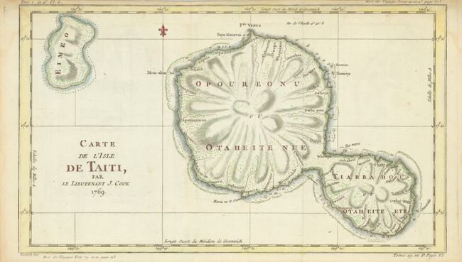
This chart of the islands of Tahiti is one of the earliest depicting the island and is a result of Cook's first voyage. Fully engraved to show the islands unique mountainous topography and the rivers which radiate from the centrally located mountain or volcano. Cook's first expedition resulted from a petition by the Royal Society to King George III requesting a scientific expedition to the Pacific to study and observe the 1769 transit of Venus across the sun from the island of Tahiti. Approval was given for the scientific voyage, which the Admiralty combined with a confidential mission to search the south Pacific for signs of the postulated continent Terra Australis Incognita. Engraved by Benard.
References:
Condition: A
Close upper margin as issued with edge toning. An area of paper thinness at lower middle visible when held to the light. Map image is very good.