Catalog Archive
Auction 134, Lot 586

"Portae Ottomanicae Regna & Ditiones per Europam, Asiam & Africam diffusae dummo Studio Descriptae", Weigel, Christopher

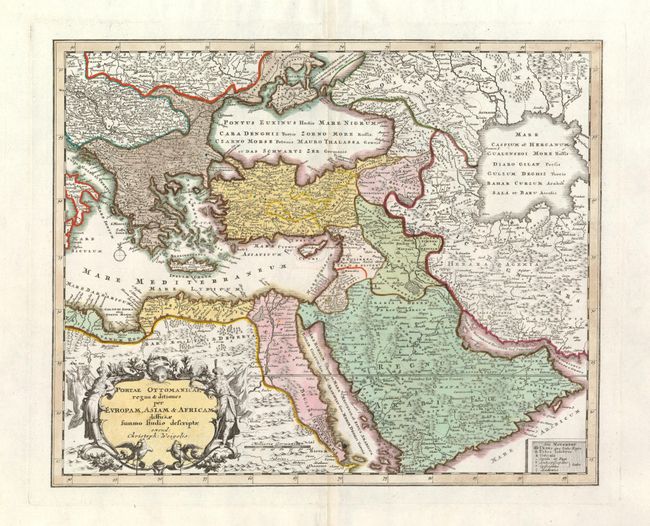
Subject: Middle East, Turkish Empire

Period: 1720 (published)

Publication: Atlas Manualis

Color: Hand Color

Size:
13.2 x 10.7 inches
33.5 x 27.2 cm
Download High Resolution Image
(or just click on image to launch the Zoom viewer)

A crisply detailed map of the Ottoman Empire, illustrating the area around the eastern Mediterranean, the Black, Caspian, Red Seas and the Persian Gulf. The attractive cartouche features two Moorish figures in full costume, eagles and a fierce cat's face. This map is a reduction of Homann's map, engraved by Michael Kauffer.

References:

Condition: B+

The image is fine with lovely color and crisp impression on a full sheet with wide margins. A small hole in map just on the shore by Barva that is mostly noticed when held to light and does not detract .

Estimate: $350 - $450

Sold for: $275

Closed on 12/1/2010

Archived