Subject: Polar
Period: 1807 (dated)
Publication:
Color: Hand Color
Size:
8.2 x 7.8 inches
20.8 x 19.8 cm
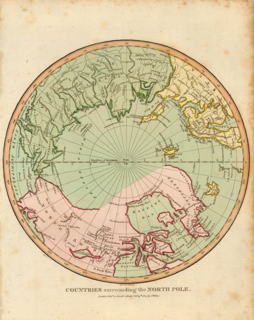
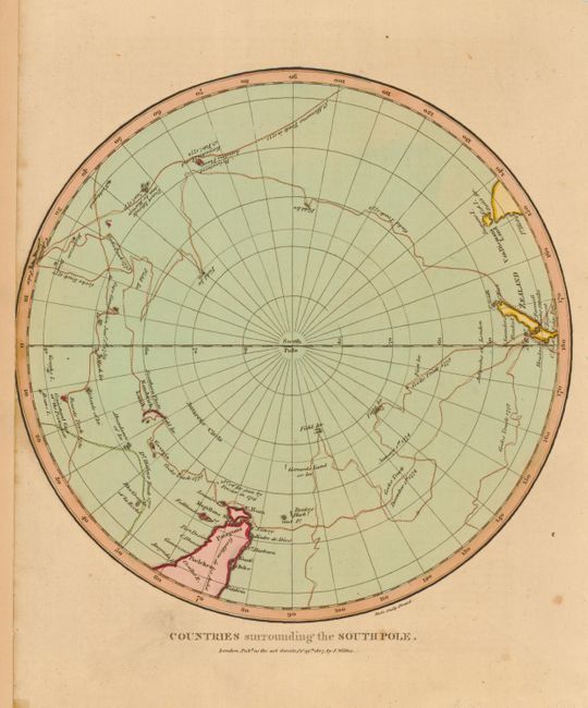
Very nice matched pair of hemispheric polar maps that detail the discoveries up to October 1807. The North polar map shows an indistinct and partially missing North American coastline. One area of the coastline labeled The Sea, 1772 is shown at the northern end of the Coppermine River and village of the Copper Indians. In the same areas are the Dog Ribb'd Indians and a large area called "Hearn's Discoveries." Also noted are Baffin's Landing Place and an area of Fresh Water is located above the Snowy Mt. in the vicinity of north-eastern Alaska. The southern hemisphere map is filled with the tracks of explorers, principally those of Captain Cook, but also of St. Allouarns (1772), Dr. Halley (1700), and Bouvets (1730). The continent of Antarctica is, of course, not delineated in this early map, but four areas of "Field Ice" are noted lying approximately between 60° and 70°, giving an early clue of discoveries to follow. Both with Wilkes' imprint below the hemisphere.
References:
Condition: B+
Both map images are very good to fine. The north map has scattered foxing in blank margins.