Subject: Versailles, France
Period: 1690 (circa)
Publication:
Color: Hand Color
Size:
56 x 18.3 inches
142.2 x 46.5 cm
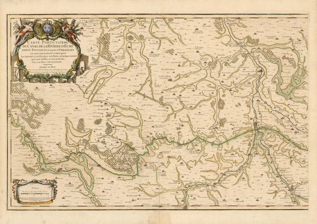
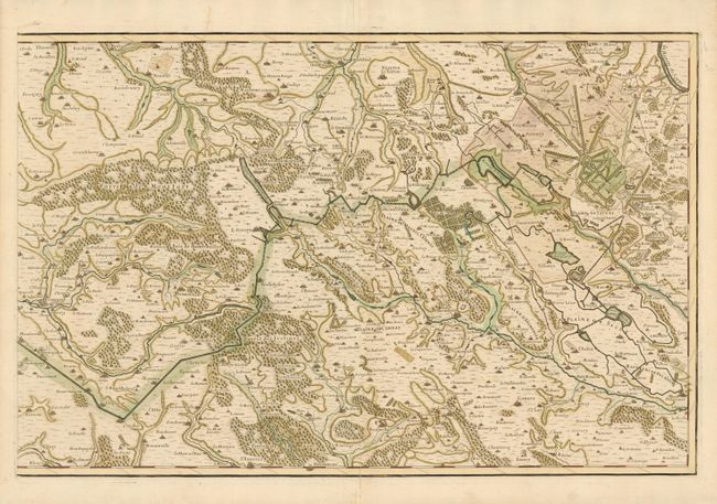
This scarce two sheet map shows in fantastic detail the 80 kilometer canal and aqueduct system, which originates at the Eure River at Pontgouin and flows eastward along a tortuous route to supply water for the gardens and fountains at Versailles. The Marechal de Vauban, official engineer to King Louis XIV, was well known for the many forts built along the French coast. This ambitious aqueduct project is considered his first 'domestic' project. The canal feeds the Estang de Villaroy, de Sacle and de Trou Salle. On the map the canal is delineated in a wide dark line and the aqueduct is engraved with a smaller red line. The aqueduct was designed to supply the fountains for the Palace of Versailles. The project was started in 1685 with 30,000 workers, but was not fully completed due to the cost of the King's wars. Existing portions of the lock system and aqueduct are tourist attractions today and drawings of the original design are on display inside the Chateau de Maintenon. It was classified as a Monument historique by the French Ministry of Culture in 1875.
Also visible on the map is the incredible la Machine de Marly that was an alternative plan to provide water for the fountains of Versailles. The machine was built on the banks of the Seine in 1684. It was a civil engineering marvel designed to pump water from the river to the chateaux of Versailles and Marly. Fourteen paddlewheels, each about 36 feet in diameter, were turned by the Seine to power more than 250 pumps, forcing river water up a series of pipes to the Louveciennes aqueduct, a 500 foot vertical rise. This incredible machine was in use until 1817, when it was updated and rebuilt.
The map has remarkable detail throughout with small towns, churches, roads, bridges and forests noted throughout. Locates the towns of Gallardon, Mounlouet, Nogent le Roy, Maintenon, Courville, Chartres, Rochefort, le Charderonnay, Lemours, Chevreuse, Cognieres, Neaufle de Chateau and many more. Excellent detail of Versailles and its grounds. Printed on two sheets (28 x 18.3") unjoined. A rare issue.
References:
Condition: B+
Beautiful examples with strong impression and fine hand coloring. On very thick hand laid paper that has split along centerfold a few inches into maps from bottom.