Subject: Britain
Period: 1760 (circa)
Publication: Hydrographie Francoise…
Color: Black & White
Size:
34 x 21.8 inches
86.4 x 55.4 cm
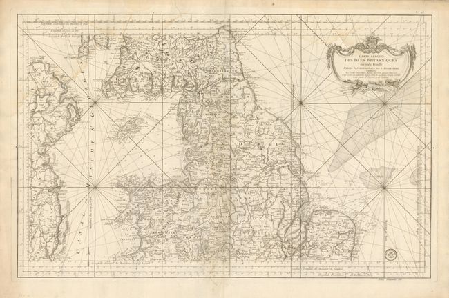
Very nice large-scale chart covers the northern part of England, southern Scotland, Wales, the Isle of Man, and the eastern coast of Ireland. The map is filled with incredible detail, both along the coastline and in the interior. Locates the cities of Yarmouth, Norwich, Okcham, Chester, Nottingham, York and Dublin plus scores of smaller towns and villages. Delineates wagon roads and trails, rivers and mountains. This map is distilled from Bellin's larger, separate maps of the British Isles. The chart is embellished by a large title cartouche with weapons along the bottom. With the Depot de la Marine stamp and the cost noted as Prix, cinquante sols.
References:
Condition: B
A long tear along centerfold has been repaired with old paper on verso. Full margins and very nice impression.