Catalog Archive
Auction 134, Lot 383

"Bowles's New Pocket Map of the Atlantic or Western Ocean, Laid down from the Latest Descoveries, and Regulated by Numerous Astronomical Observations", Bowles, Carrington

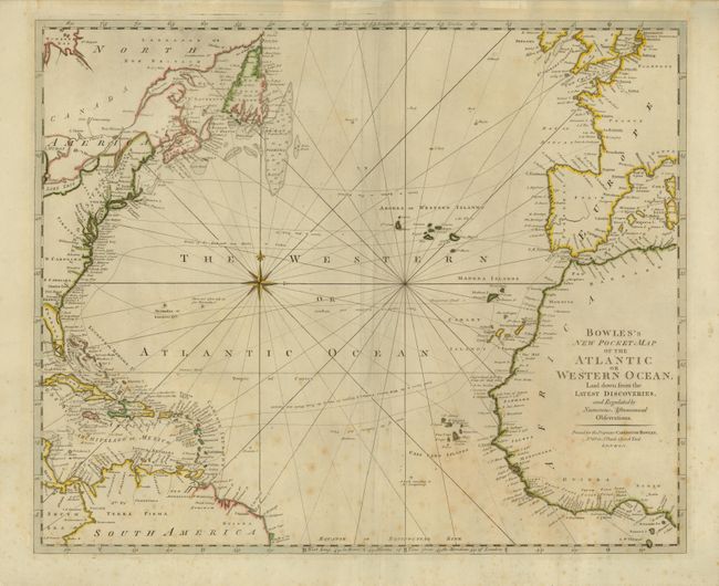
Subject: Atlantic Ocean

Period: 1780 (circa)

Publication:

Color: Hand Color

Size:
21.7 x 17.7 inches
55.1 x 45 cm
Download High Resolution Image
(or just click on image to launch the Zoom viewer)

This is an uncommon map of the Atlantic Ocean, showing the trade routes from Europe to the various European colonies, including Virginia and the Carolinas, the Cadiz Galleon Routes, and tracks to the West Indies. There is good detail along the Atlantic Seaboard of North America, which is noted as the XIII United States. The Great Fishing Banks are noted off Newfoundland, good detail of the Madera, Canary and Cape Verde Islands, along the coast of Africa, and throughout the Caribbean.

References:

Condition: B

Crisp, early impression on a very thick sheet with original margins. Some extra creases along centerfold and foxing in lower portion.

Estimate: $275 - $325

Sold for: $375

Closed on 12/1/2010

Archived