Subject: Venezuela
Period: 1804 (dated)
Publication:
Color: Hand Color
Size:
23 x 17 inches
58.4 x 43.2 cm
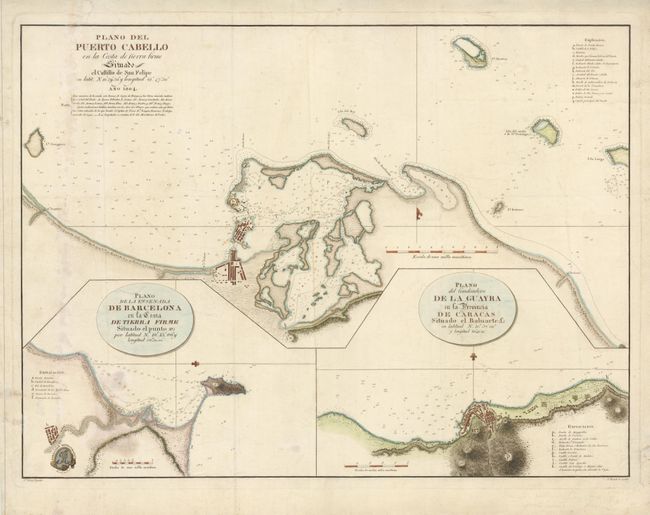
At the end of the eighteenth century, the Spanish navy organized a hydrographic expedition to make maps of the Gulf of Mexico, the Antilles, and the northern coast of South America. This expedition is less-known than that of Malaspina, but was of equal importance and produced many important maps. There are three detailed nautical plans on this sheet. The chart at top shows Puerto Cabello according to the observations of Joaquin Francisco Fidalgo in 1794. At bottom left is a plan of Barcelona, the capital of the modern state of Anzoátegui. At right is a detailed plan of La Guaira, capital of the modern state of Vargas. Each chart includes a key to the important locations. Drawn by J. Morata and engraved by F. Selma.
References:
Condition: B
The chart shows signs of having actually been used at sea. There are some old extraneous folds and some stains within the map, and some old repairs in the blank margins.