Subject: South America
Period: 1783 (dated)
Publication: Universal Atlas…
Color: Hand Color
Size:
14.2 x 14.2 inches
36.1 x 36.1 cm
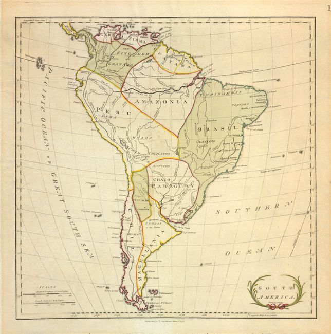
This map of the continent shows limited detail of rivers and mountains and is divided into just ten regions: Magellania, Chili, Peru, Tucuman, Paraguay, Brasil, Maazonia, Guayana, Kingdom of Granada and Terra Firma. The Amazon River extends to the Andes but shows only limited tributaries. Includes the Galapagos Isles, the Falklands, the Strait of Magellan and part of Central America. Small floral-themed title cartouche at lower right. Maps by Stackhouse are uncommon.
References:
Condition: B+
The map has wide margins, larger at top and bottom folding under apparently as issued. Light overall toning within map with lighter area outside of map image from old framing job. Extraordinary watermark is a large fleur-de-lys with "GR" below.