Subject: Lesser Antilles, St. Kitts
Period: 1758 (dated)
Publication: Hydrographie Francoise…
Color: Hand Color
Size:
34.3 x 23 inches
87.1 x 58.4 cm
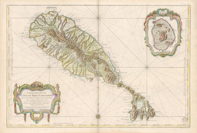
Superb large-scale sea chart of St. Kitts vividly detailing the dramatic topography and settlements. The settlements and forts are clearly shown as well as the favorable anchorages and dangerous parts of the coastline. St. Kitts, the oldest British colony in the West Indies, was alternately held by Britain, France and Spain throughout the 17th century. It was finally ceded to Britain at the Treaty of Utrecht in 1713. An elaborate cartouche surrounds an inset of the island of Nevis, which is balanced with an equally elaborate title cartouche. This is a Depot de la Marine issue with Prix un franc et demi.
References: cf Tooley (MCC-81) St. Kitts #32, plt. 5.
Condition: B+
A short fold separation at bottom has been repaired with tissue on verso.