Subject: Caribbean
Period: 1765-1825
Publication:
Color:
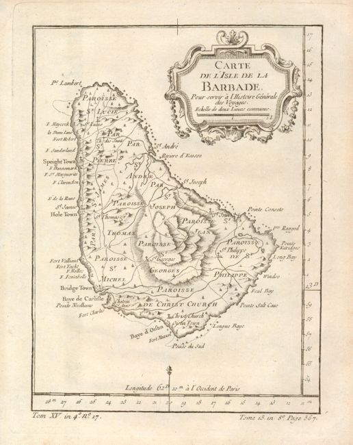
1) Carte de l'Isle de la Barbade, by Jacques Nicolas Bellin, from Prevost's Histoire Generale des Voyages, circa 1765, black & white, (5.8 x 7.8") The island of Barbados is divided into eleven parishes with a well developed network of roads throughout the island. (A)
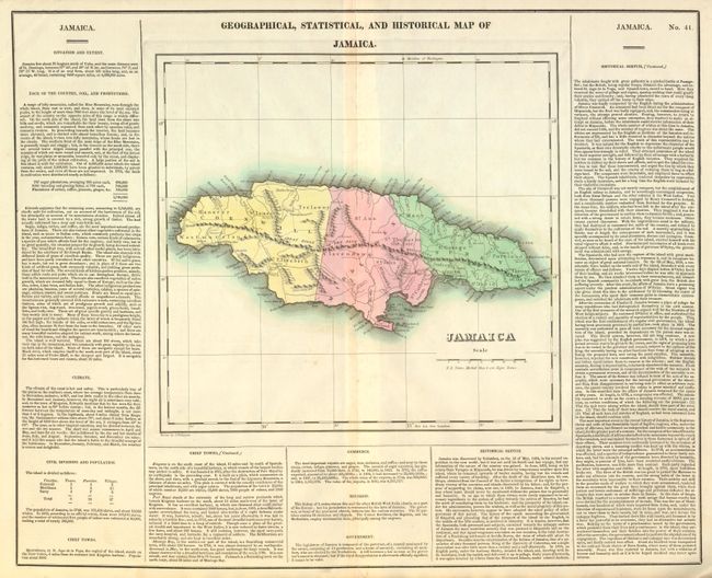
2) Geographical, Statistical, and Historical Map of Jamaica, by Carey & Lea, circa 1825, hand color, 12 x 11.3" on a 20.5 x 16.5" sheet with text. Divided into three parishes with good detail of settlements, roads, watershed and topography. Scores of place names along coastline. (B+)
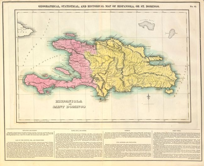
3) Geographical, Statistical, and Historical Map of Hispaniola, or St. Domingo, by Carey & Lea, circa 1825, hand color, 18 x 11.5" on a 20.5 x16" sheet with text. Long split at centerfold enters map. (B)
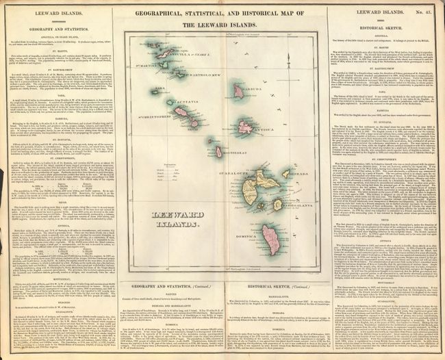
4) Geographical, Statistical, and Historical Map of the Leeward Islands, by Carey & Lea, circa 1825, hand color, 9.2 x 11.5" on a 20.5 x 16.5" sheet with text. A brightly colored map of islands from Anguilla to Dominica. The map is nicely engraved and surrounded by informational text that provides many interesting facts and descriptions. A small key at left shows the possessions of the British, French, Dutch and Swedes. Toned along centerfold. (B)
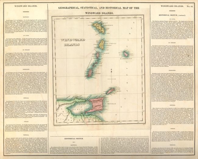
5) Geographical, Statistical, and Historical Map of the Windward Islands, by Carey & Lea, circa 1825, hand color, 10 x 11.8" on a 20.6 x 16.5" sheet with text. Extends from Martinique to Trinidad with the Gulf of Paria and a portion of Columbia. Laid down on board. (B)
References:
Condition:
See individual descriptions.