Subject: Oklahoma
Period: 1904 (published)
Publication: 11th Annual Report Commission Five Civilized Tribes
Color: Printed Color
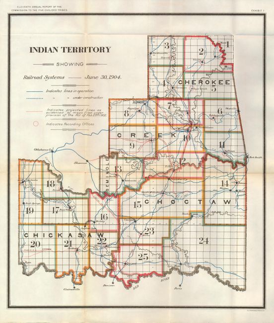
A fine set of maps published as part of the Eleventh Annual Report of the Commission to the Five Civilized Tribes. The Commission was appointed to negotiate with the Five Tribes for the extinguishment of their tribal title to lands by allotment, and division of the same among the members of the tribes. This commission became known as the Dawes Commission, after Senator Henry L. Dawes, who was largely responsible for the legislation. Their main task was to make an equitable division of nearly twenty million acres of land among more that 100,000 Indians. In 1895 the USGS began to conduct surveys of all lands in Indian Territory into townships, ranges and sections. These maps were used by the Dawes Commission to assist the citizens on the tribal rolls to select their individual plats of land. This set of colorful folding maps contains the following:
1) Indian Territory Showing Railroad Systems, June 30, 1904 (15.5 x 17.8") This map shows the region that was to become the Indian proposed State of Sequoyah. Toned along one fold. (B+)
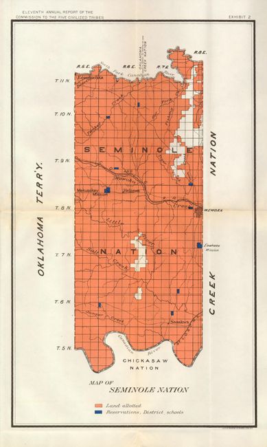
2) Map of Seminole Nation (9.2 x 15.2") Locates Mekusukey Mission, Wewoka, Emahaka Mission and Heliswa. Lightly toned along horizontal fold. (B+)
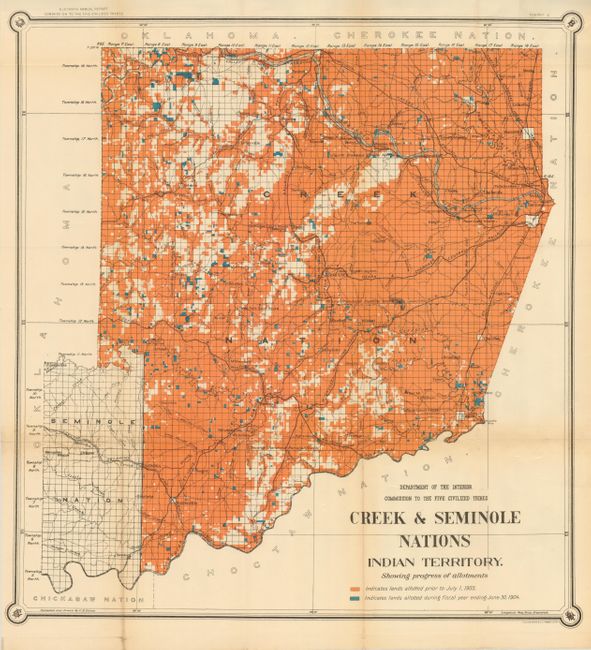
3) Creek & Seminole Nations Indian Territory (24" x 25.5"). Shows agricultural, rocky, hilly and mountain land owned by the tribes. Oklahoma is to the west and the Choctaw and Cherokee Nations are to the east. Details include railroads, towns and villages, missions and court houses. Coloring indicates lands allotted prior to July 1, 1903 and those allocated up to June 30, 1904. One fold with light toning. (B+)
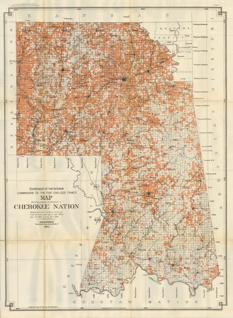
4) Map Showing progress of Allotment in Cherokee Nation (25.5" x 35"). Very detailed map that shows the progress of selections filed since Opening of Land Office Jan 1st 1903 to June 30th 1904. Lightly toned along one fold. (B+)
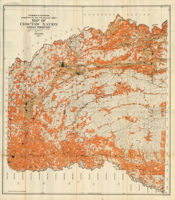
5) Map of Choctaw Nation Indian Territory (33" x 36.5"). Interesting map showing coal leases per the Choctaw and Chickasaw Agreement of 1898 along with the names of lessees in a table under the title. Also provides a detailed view of the rivers and creeks, railroads and towns. Very nice example. (A)
6) Map of Choctaw Nation Indian Territory Coal and Asphalt Segregation and Pine Timber of Commercial Value (33" x 36.5"). Lightly toned along one fold, else very good. (B+)
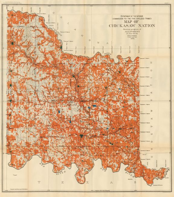
7) Map of the Chickasaw Nation (30" x 32.5"). This large, bold map shows the land allotments for the Chickasaw Nation in the region between the Canadian and Red Rivers. Color designates agricultural, mountain and rocky lands. Generally very good. (A)
References:
Condition:
See individual descriptions.