Subject: District of Columbia
Period: 1888 (circa)
Publication:
Color: Black & White
Size:
20.5 x 16.5 inches
52.1 x 41.9 cm
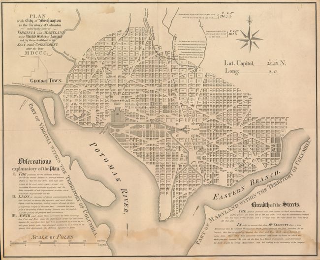
This is apparently a restrike of the Samuel Hill version of Ellicott's 1792 map, possibly from the original plate. It lacks the attribution to Hill under the title but is obviously engraved and otherwise identical to the original. In the upper left corner is the number "3043" and "Price 45 Cents." Ellicott's original plan of Washington was first published in Boston and Philadelphia in 1792 and was engraved by Samuel Hill. The plan shows the original design for the city by the French architect and Revolutionary War veteran Pierre-Charles L’Enfant. The plan shows excellent detail including all numbered city blocks, the Capitol, and the President's House, but Georgetown is simply outlined. In 1792 at the start of his second term, President Washington appointed Ellicott the first Surveyor General of the United States. The Library of Congress has this version dated 1888, the source of our dating.
References:
Condition: B+
Light water stains across bottom and a small area at upper left.