Subject: Western United States
Period: 1888 (circa)
Publication:
Color: Printed Color
Size:
15.6 x 11.8 inches
39.6 x 30 cm
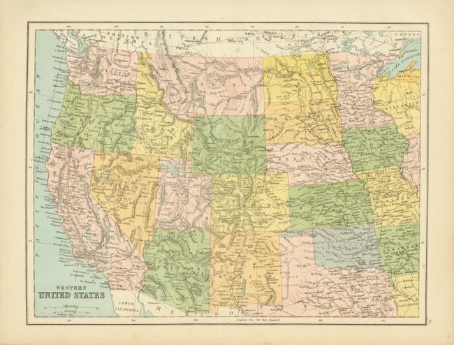
At first glance this appears to be a common map of the western United States from the 1880s. However this map has the rarely seen territorial name of Lincoln in place of North Dakota. The Territory of Lincoln was first proposed by the US Senate in 1878, not as the northern half of a north-south split of Dakota Territory but as the western half of an east-west split of Dakota territory. In December of 1887, Senator Manderson of Nebraska introduced a bill to admit the southern part of Dakota Territory as a state and organize the northern part as the Territory of Lincoln. The maker of this map apparently went to press on this news, but the bill never became law. The map is filled with detail and uses printed color to delineate the states and territories.
References:
Condition: A+
Bright color and good impression.