Subject: Western Hemisphere
Period: 1800-1856 (circa)
Publication:
Color: Hand Color
This lot consists of 3 nice thematic maps.
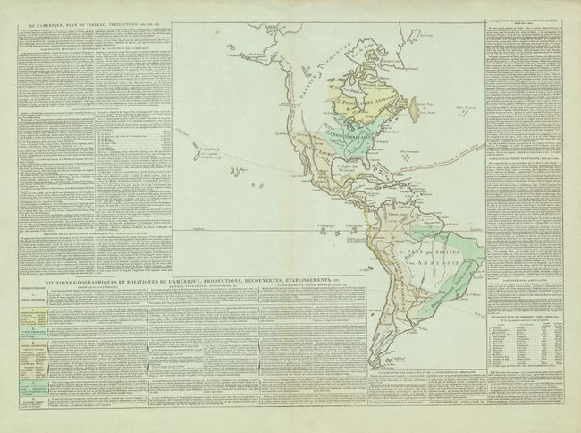
1) De l'Amerique, Plan du Tableau..., Didot, 1807 (25 x 17.7") This uncommon map of the Americas shows the political divisions and colonial possessions. Surrounded by detailed historical text and tables of information including the capitals and populations for the United States and its territories. The map includes a rudimentarily shaped Alaska (Alasca) and a note along the Northwest coast concerning Vancouver's discoveries. It also includes the Sandwich Islands, with a note about Captain Cook's discovery of them in 1779. The tracks of Christopher Columbus, Cortez and Pizzaro are shown as well.
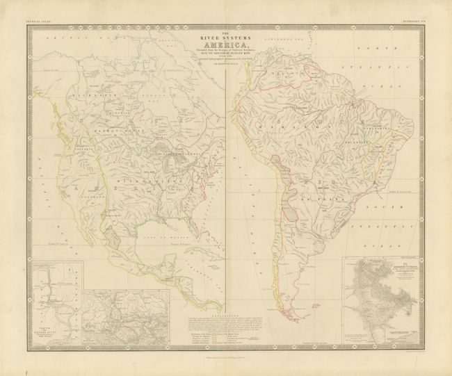
2) The River Systems of America, A.K. Johnston, from The Physical Atlas of Natural Phenomena, circa1856 (22.5 x 18.5") This chart is from the English version of Heinrich Berghaus' Physikalischer Atlas, which resulted in the first truly comprehensive thematic atlas. It includes insets of Niagara River/Falls; Mississippi Delta; Orinoco/Maranon Rivers. Published in Edinburgh by William Blackwood & Sons.
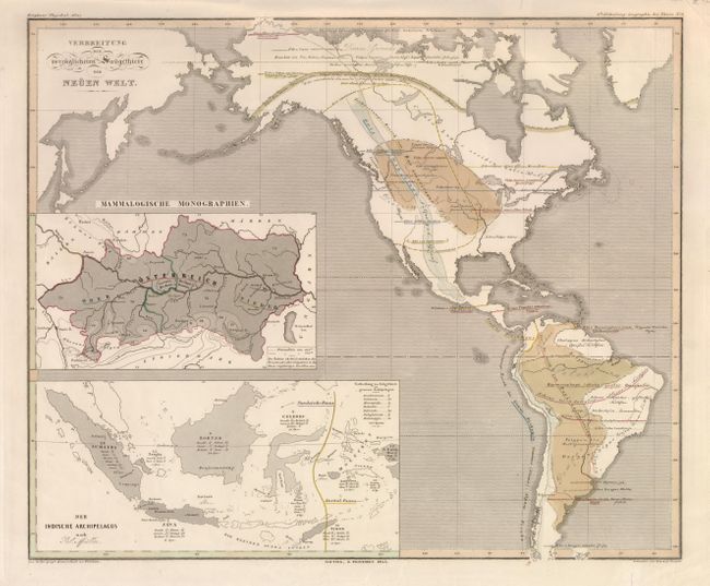
3) Verbreitung de vorzuglicheren Saugethiere er Neuen Welt, Heinrich Berghaus, from Physikalischer Atlas, 1845 (16 x 13.3") This interesting chart shows the distribution of mammals in the Americas with insets of the heart of Europe and Southeast Asia for comparison.
References:
Condition: B+
Some crumpling and repaired tears in margins, else very good.