Subject: Exploration and Surveys
Period: 1774 (dated)
Publication:
Color: Black & White
Size:
8 x 10 inches
20.3 x 25.4 cm
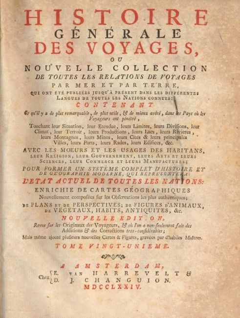
This is a very nice example of the most desirable volume of this multi-volume work of Prevost. This is the 1774 Amsterdam "Nouvelle Edition" published by Van Harrevelt & Changuion. Covers the explorations of Greenwill, Raleigh, Jena White, Gosnold, the Establishment of Virginia, Jean de Ribaut, Jean Smith, Champlain, L'Escarbot, Marquette, Charleviox and many more. Individual chapters for all of the British Colonies in North America as well as significant coverage of South America, Hudson Bay, etc..
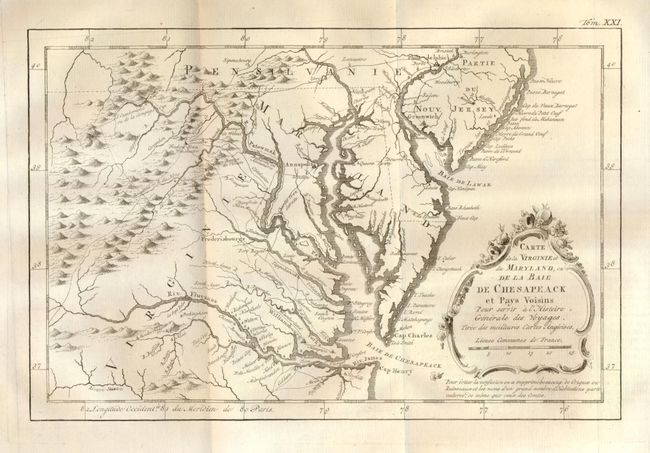
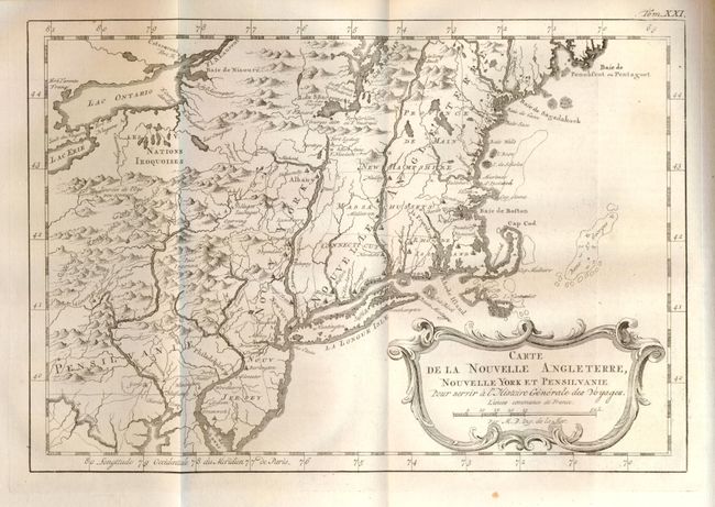
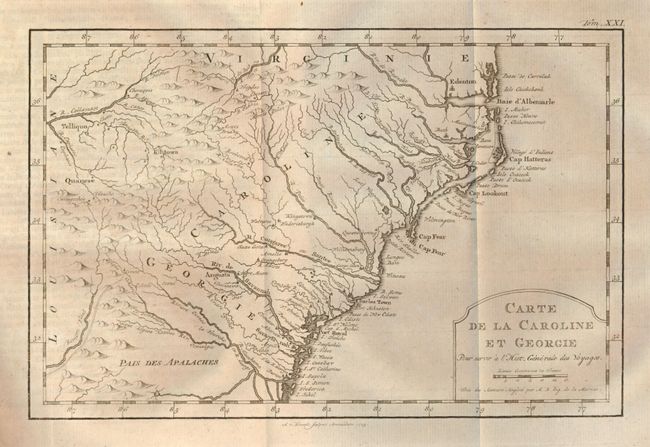
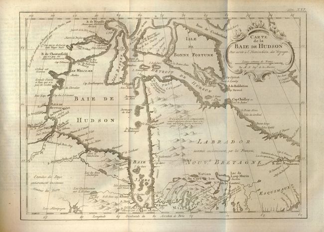
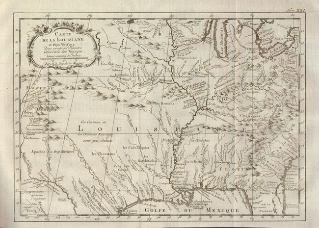
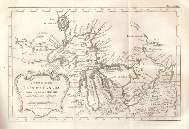
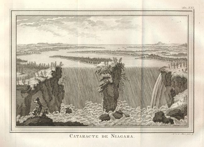
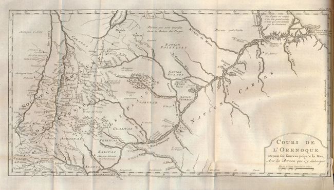
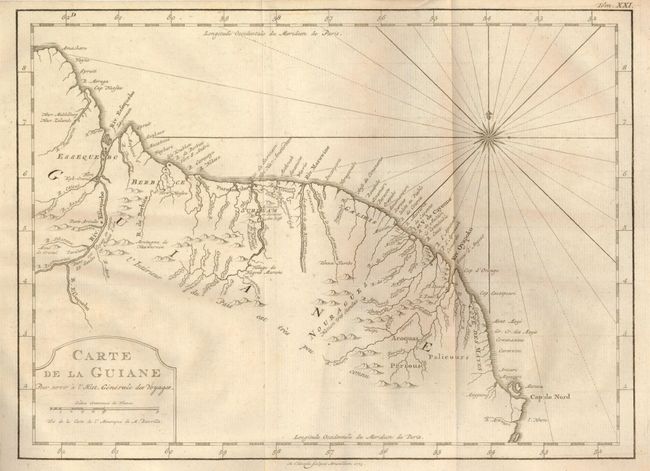
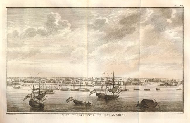
The book has numerous illustrations as well as 12 folding maps and 7 full-page maps and 2 foldout views. The maps and plans: 1) Carte de la Guiane 9"x 12"; 2) Cours de L'Orenoque 9"x 17"; 3) Carte de la Colonie de Surinam 8"x 16"; 4) Carte Paticuliere D'une Partie des Rivieres de Berbice et de Canje, Pour l'intelligence de la Relation touchant La Revolte des Negres en 1763 7"x 10"; 5) Carte de la Virginie et du Maryland, ou De La Baie de Chesapeack, 7"x 11"; 6) Carte de la Nouvelle Angleterre 8"x 12"; 7) Carte de la Caroline et Georgie 7"x 11"; 8) Carte de la Baie de Hudson 8"x 'x 11"; 9) Carte de L'Arcadie et Pais Voisins 8"x 12"; 10) Carte Du Cours Du Fleuve De S'Laurent 11.7" x 7.3"; Suite du Cours Du Fleuve De St. Laurent 7"x 11"; 12) Carte de Lacs de Canada 7"x 11"; 13) Carte de la Louisiane 8"x 12"; 14) Plan de la Nouvelle Orleans 7"x 11"; 15) Plan de la Ville de Quebec 7"x 11"; 16) Plan de la Ville de Boston. There are 6 single page river system maps of Guiane. Also folding "Vue Perpective de Paramaribo" 7"x 12", and the view "Cataracte de Niagara" 7"x 10". There also numerous full-page illustrations throughout the book.
Hardbound, title page, Advertisement, Table des Titles et Paragraphes, 531pp, maps and plates. A great example of Prevost's work filled with maps by Bellin.
References:
Condition: A
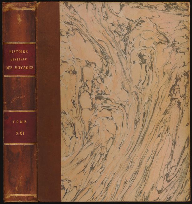
Rebound in the late 19th century with full leather spine and marbled paper over boards, red leather title labels on spine with gilt tooling, and marbled end papers. Some minor wear to the covers, certainly very good. Internally there is some light foxing which seems to be mostly confined to the outer pages. The maps and plates are all very nice, condition varies very good to fine.