Subject: Atlases
Period: 1835 (published)
Publication:
Color: Hand Color
Size:
5.7 x 8.8 inches
14.5 x 22.4 cm
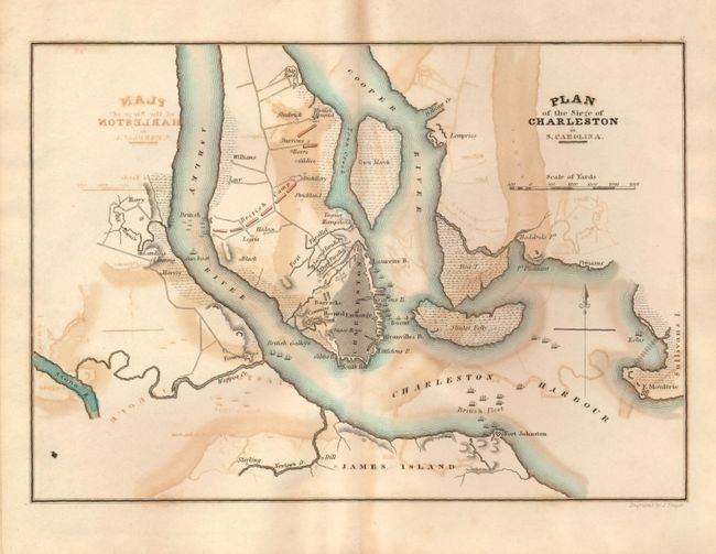
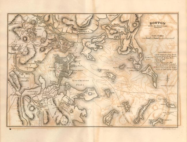
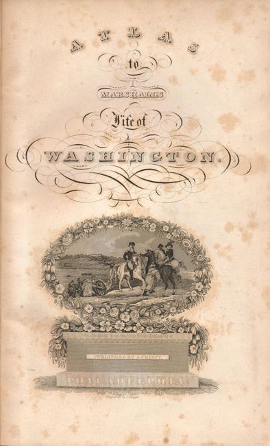
This atlas features ten maps showing the positions and movements of General Washington, and several other British and American generals, which describe events during the American Revolutionary War. The title page has a finely engraved vignette of Washington crossing the Delaware River. This small atlas was published by J. Crissy in 1835. Complete atlas with all maps. Original hard boards with a paper label on the front cover. The ten maps measure approximately 9" x 7" and include the following:
1) Boston with its Environs
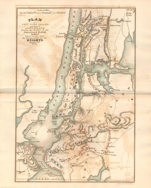
2) Plan of New York Island and part of Long Island Shewing the Position of the American & British Armies before and after the Engagement on the Heights August 27th 1776.
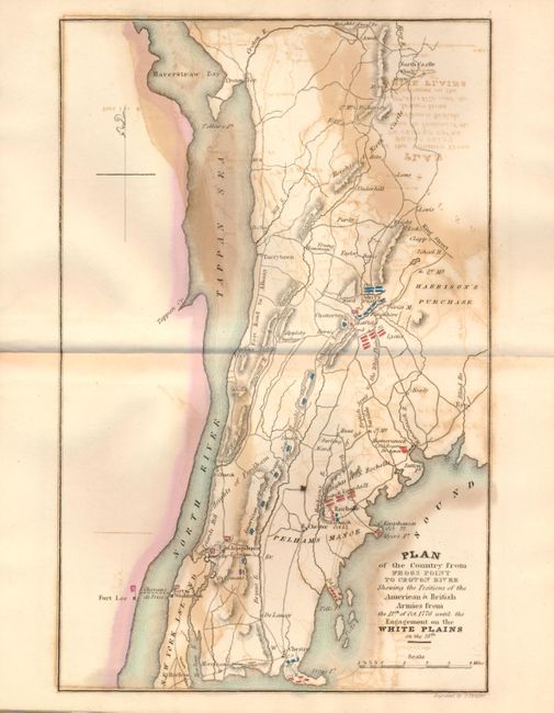
3) Plan of the Country from Frogs Point to Croton River Shewing the Positions of the American & British Armies from the 12th of Oct. 1776 until the Engagement on the White Plains.
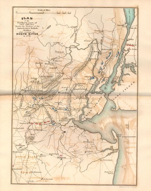
4) Plan of the Northern part of New Jersey Shewing the Positions of the American & British Armies after crossing the North River in 1776.
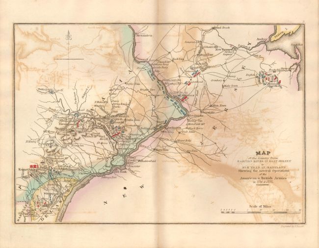
5) Map of the Country from Raritan River in East Jersey to Elk Head in Maryland. Shewing the several Operations of the American & British Armies in 1776 & 1777.
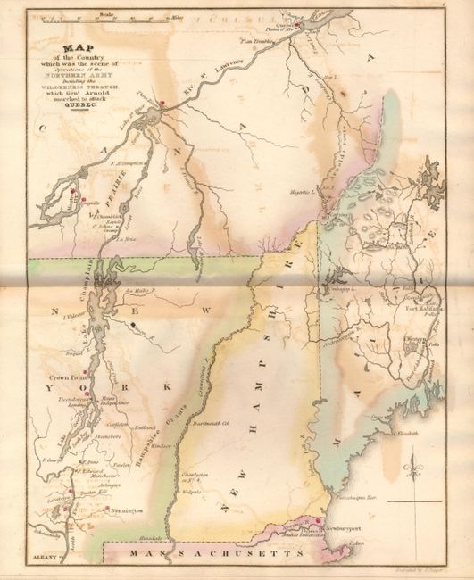
6) Map of the Country which was the scene of Operations of the Northern Army Including the Wilderness Through which Genl. Arnold marched to attack Quebec.
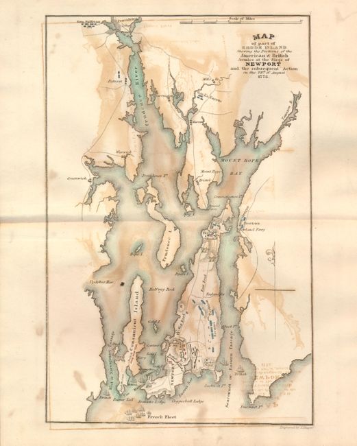
7) Map of part of Rhode Island Shewing the Positions of the American & British Armies at the Siege of Newport and the subsequent Action on the 29th of August 1778.
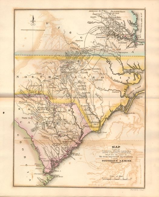
8) Map of part of Virginia Northern Carolina South Carolina & Georgia which were the scenes of the most important Operations of the Southern Armies.
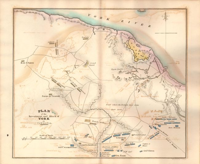
9) Plan of the Investment and Attack of York in Virginia.
10) Plan of the Siege of Charleston in S. Carolina
References:
Condition: B
The covers are sound with a little soiling and sunned spine. End papers and title page are foxed. The maps all have overall offsetting.